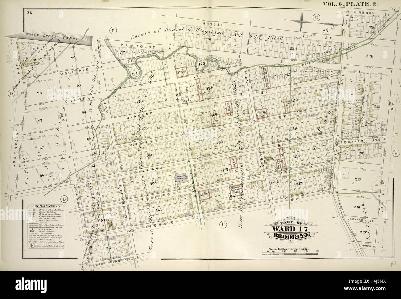
Vol. 6. Plate, E. Map bound by Whale Creek Canal, Humboldt St., Norman Ave., Russell St., Van Cott Ave., N.Henry St.
RMID:Image ID:H4J5NX
Image details
Contributor:
Penta Springs Limited / Alamy Stock PhotoImage ID:
H4J5NXFile size:
75.6 MB (3.3 MB Compressed download)Releases:
Model - no | Property - noDo I need a release?Dimensions:
6245 x 4233 px | 52.9 x 35.8 cm | 20.8 x 14.1 inches | 300dpiDate taken:
10 August 2014Photographer:
ArtokoloroMore information:
This image could have imperfections as it’s either historical or reportage.
Vol. 6. Plate, E. Map bound by Whale Creek Canal, Humboldt St., Norman Ave., Russell St., Van Cott Ave., N.Henry St., Van Pelt Ave., Lorimer St., Leonard St., Meserole Ave., Manhattan Ave., Calyer St., Oakland St., Green Point Ave.; Including Moultrie S., New York, USA