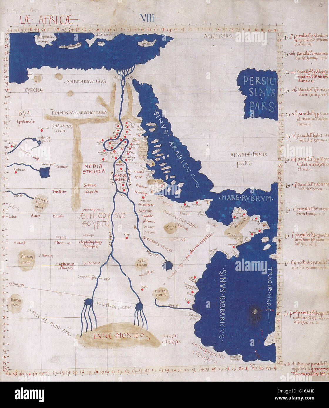
Ptolemy's map of the Nile was based on the description contained in Ptolemy's book Geographia, written 150 AD. Although authentic maps have never been found, the Geographia contains thousands of references to various parts of the old world, with coordinat
Image details
Contributor:
Science History Images / Alamy Stock PhotoImage ID:
G16AHEFile size:
37.8 MB (4.9 MB Compressed download)Releases:
Model - no | Property - noDo I need a release?Dimensions:
3376 x 3918 px | 28.6 x 33.2 cm | 11.3 x 13.1 inches | 300dpiPhotographer:
Photo ResearchersMore information:
This image could have imperfections as it’s either historical or reportage.
Ptolemy's map of the Nile was based on the description contained in Ptolemy's book Geographia, written 150 AD. Although authentic maps have never been found, the Geographia contains thousands of references to various parts of the old world, with coordinates for most, which allowed cartographers to reconstruct Ptolemy's world view when the manuscript was re-discovered around 1300 AD. Perhaps the most significant contribution of Ptolemy and his maps is the first uses of longitudinal and latitudinal lines and the specifying of terrestrial locations by celestial observations. When his Geographia was translated from Greek into Arabic in the 9th century and subsequently into Latin in Western Europe at the beginning of the 15th century, the idea of a global coordinate system revolutionized medieval Islamic and European geographical thinking and put it upon a scientific and numerical basis.