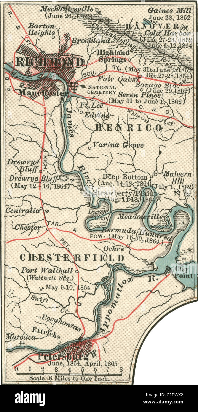
Map of Richmond
RMID:Image ID:C2DWX2
Image details
Contributor:
Universal Images Group North America LLC / Alamy Stock PhotoImage ID:
C2DWX2File size:
18.2 MB (1.8 MB Compressed download)Releases:
Model - no | Property - noDo I need a release?Dimensions:
1810 x 3520 px | 15.3 x 29.8 cm | 6 x 11.7 inches | 300dpiPhotographer:
Encyclopaedia Britannica, Inc.More information:
This image could have imperfections as it’s either historical or reportage.
Map illustrating battles of the American Civil War held around the Richmond, Virginia, area. Map from the 10th edition of Encyclopaedia Britannica, circa 1900.