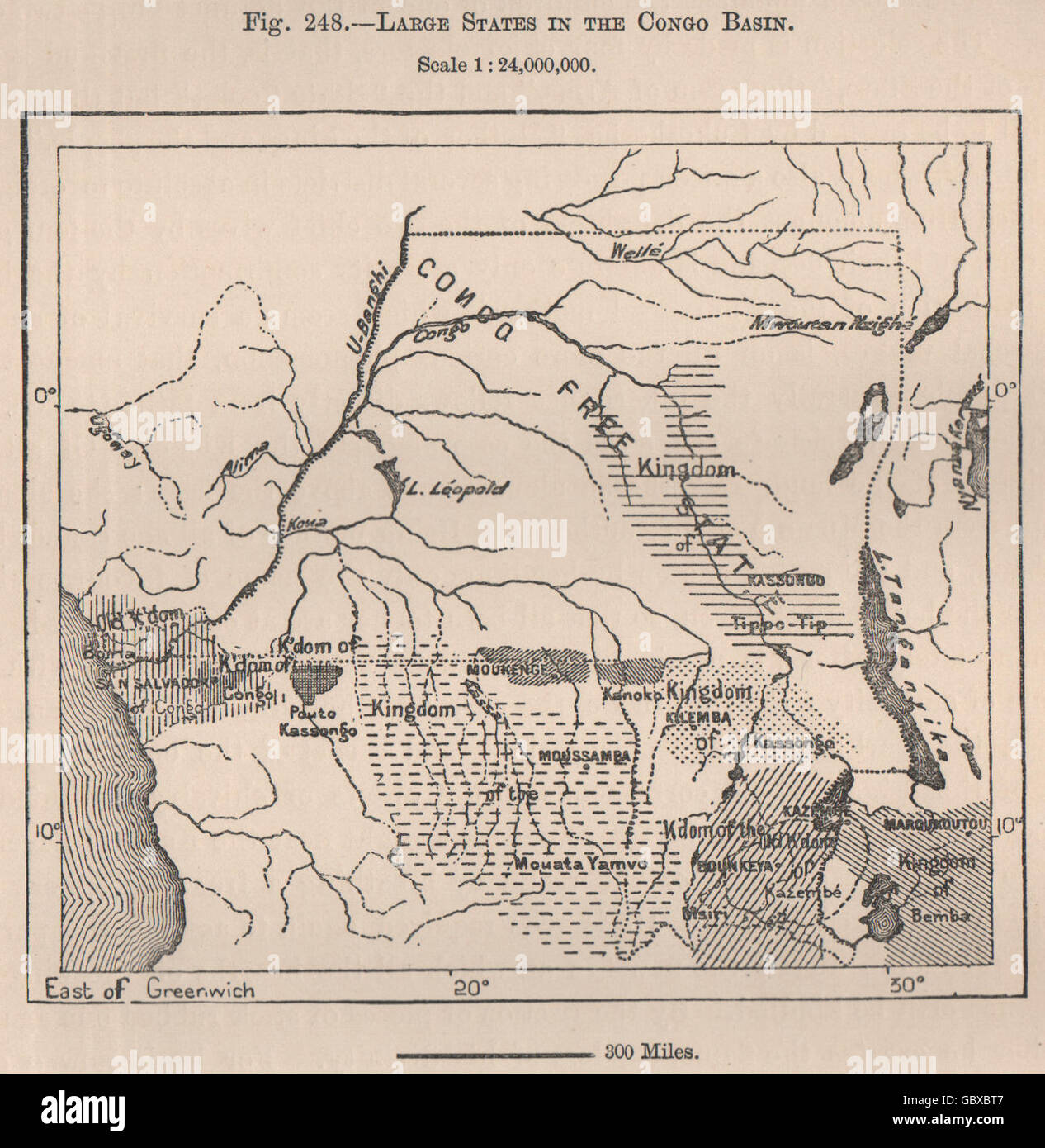
Large States in the Congo Basin. Congo Free State. Angola. DR Congo, 1885 map
RFID:Image ID:GBXBT7
Image details
Contributor:
Antiqua Print Gallery / Alamy Stock PhotoImage ID:
GBXBT7File size:
5.2 MB (384.8 KB Compressed download)Releases:
Model - no | Property - noDo I need a release?Dimensions:
1337 x 1372 px | 22.6 x 23.2 cm | 8.9 x 9.1 inches | 150dpiDate taken:
1885Location:
CongoMore information:
This image could have imperfections as it’s either historical or reportage.
'Large States in the Congo Basin'. Artist/engraver/cartographer: Engraved for Élisée Reclus. Provenance: "The Universal Geography"; by Élisée Reclus, Edited by A.H. Keane, Published by J.S. Virtue & Co., London. Type: Antique wood-engraved map; Scale 1:24, 000, 000.