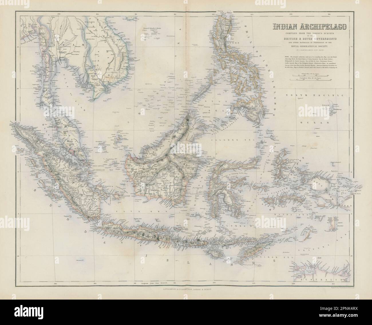
Indian Archipelago. East Indies Indonesia Philippines Malaysia SWANSTON 1860 map
RFID:Image ID:2PNK4RX
Image details
Contributor:
Antiqua Print Gallery / Alamy Stock PhotoImage ID:
2PNK4RXFile size:
98 MB (3.7 MB Compressed download)Releases:
Model - no | Property - noDo I need a release?Dimensions:
6516 x 5256 px | 55.2 x 44.5 cm | 21.7 x 17.5 inches | 300dpiDate taken:
1860Location:
East IndiesMore information:
This image could have imperfections as it’s either historical or reportage.
Indian Archipelago compiled from the various surveys of the British & Dutch Governments &c. and other materials in the possession of the Royal Geographical Society. Artist/engraver/cartographer: Engraved by J Bartholomew . Provenance: "The Companion Atlas to The Gazetteer of the World", by George Heriot Swanston, published by A Fullarton & Co. Type: Antique atlas map with original hand colour.