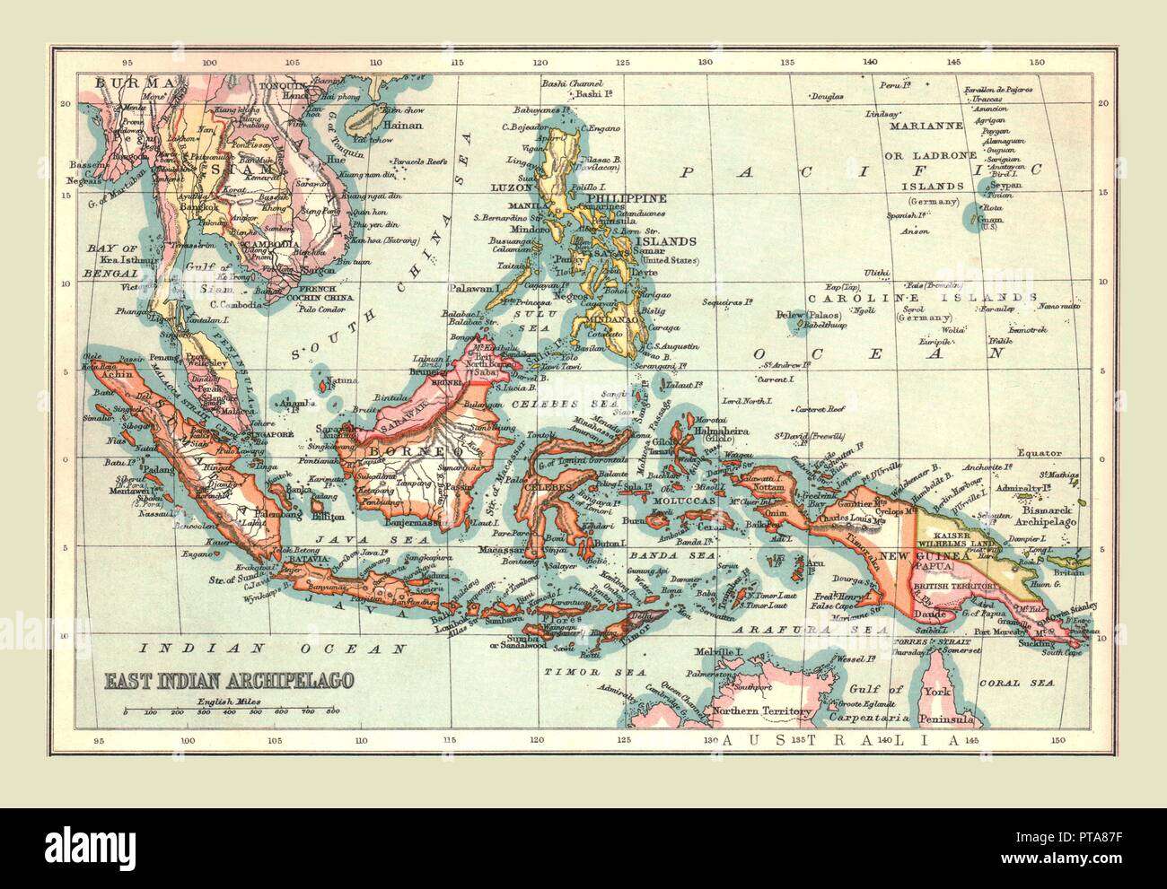
Map of the East Indian Archipelago, 1902. Creator: Unknown.
RMID:Image ID:PTA87F
Image details
Contributor:
The Print Collector / Alamy Stock PhotoImage ID:
PTA87FFile size:
47.3 MB (2.3 MB Compressed download)Releases:
Model - no | Property - noDo I need a release?Dimensions:
4885 x 3386 px | 41.4 x 28.7 cm | 16.3 x 11.3 inches | 300dpiDate taken:
1902Location:
World,Asia,East Indies,World,Asia,New Guinea,World,Asia,Indonesia,Sumatra,World,Asia,PhilippinesPhotographer:
The Print Collector/Heritage ImagesMore information:
This image could have imperfections as it’s either historical or reportage.
Map of the East Indian Archipelago, 1902. Showing Java, Sumatra, Borneo, Siam, The Philippines, Papua New Guinea and the South China Sea. From The Century Atlas of the World. [John Walker & Co, Ltd., London, 1902]