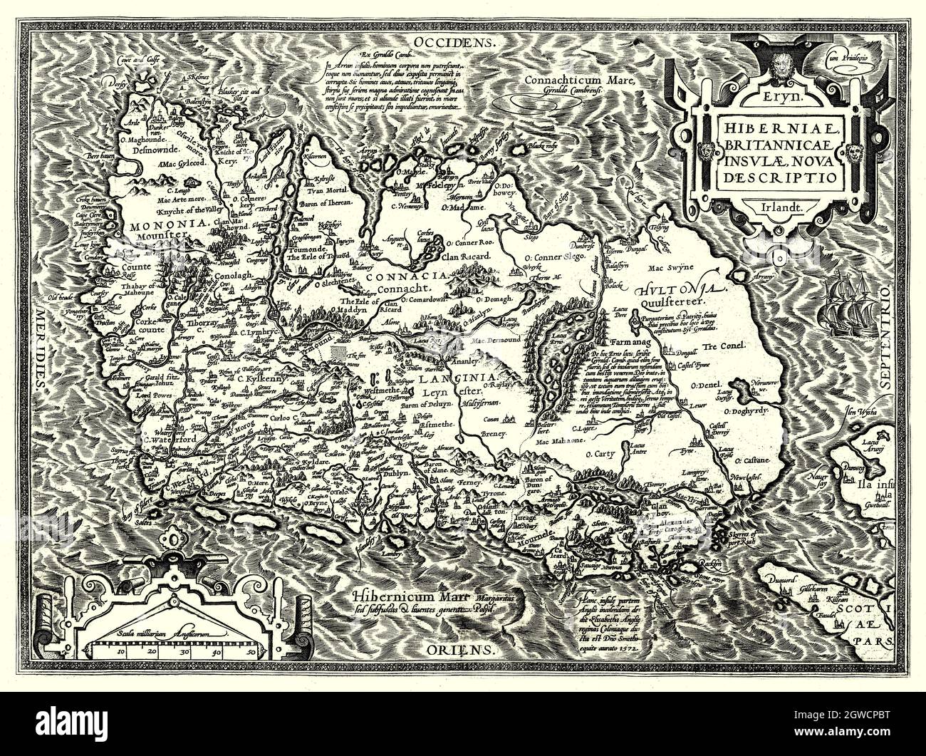
"Hiberniae, Britannicae Insvlae nova descripto." Translation: a new description of Ireland and the British Island, is in Latin and is lying with its northern coast to the west. The map, was created in 1598 by Abraham Ortelius (1527-1598), a Dutch cartographer, geographer, and cosmographer, conventionally recognized as the creator of the first modern atlas, the Theatrum Orbis Terrarum (Theatre of the World).
RMID:Image ID:2GWCPBT
Image details
Contributor:
De Luan / Alamy Stock PhotoImage ID:
2GWCPBTFile size:
70 MB (8 MB Compressed download)Releases:
Model - no | Property - noDo I need a release?Dimensions:
5721 x 4275 px | 48.4 x 36.2 cm | 19.1 x 14.3 inches | 300dpiDate taken:
17 June 1999Location:
IrelandMore information:
This image is a public domain image, which means either that copyright has expired in the image or the copyright holder has waived their copyright. Alamy charges you a fee for access to the high resolution copy of the image.
This image could have imperfections as it’s either historical or reportage.