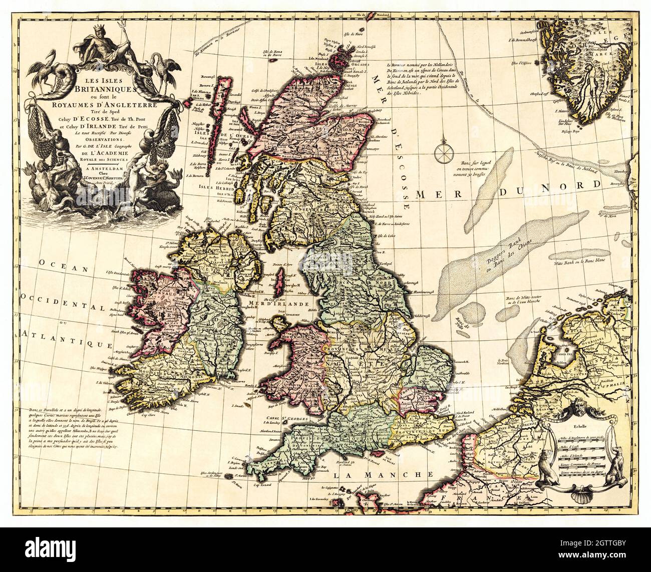
British Isles In Early 18th Century Map - United Kingdom, Great Britain map, 1700s.
RFID:Image ID:2GTTGBY
Image details
Contributor:
Bill Waterson / Alamy Stock PhotoImage ID:
2GTTGBYFile size:
78.4 MB (4.9 MB Compressed download)Releases:
Model - no | Property - noDo I need a release?Dimensions:
5819 x 4712 px | 49.3 x 39.9 cm | 19.4 x 15.7 inches | 300dpiMore information:
This image could have imperfections as it’s either historical or reportage.
Les Isles Britanniques: ou sont le Royaume d'Angleterre tire ́de Sped celuy d'Ecosse tire ́de Th. Pont et celuy d'Irlande tire de Petti, Le tout rectifie ́par diverses observations (ca. 1700s) by Guillaume de L'Isle. Original from Library of Congress. Digitally enhanced by rawpixel.