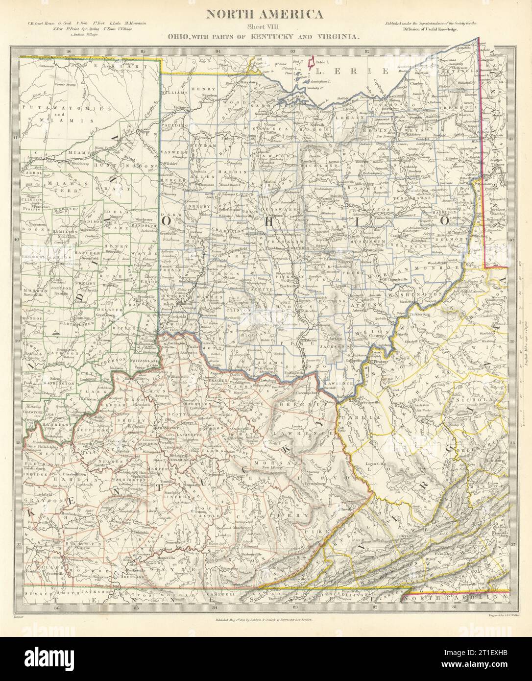
USA. Ohio with parts of Kentucky, Virginia & Indiana. Counties. SDUK 1844 map
RFID:Image ID:2T1EXHB
Image details
Contributor:
Antiqua Print Gallery / Alamy Stock PhotoImage ID:
2T1EXHBFile size:
209 MB (14.1 MB Compressed download)Releases:
Model - no | Property - noDo I need a release?Dimensions:
7813 x 9348 px | 66.2 x 79.1 cm | 26 x 31.2 inches | 300dpiDate taken:
1844Location:
United StatesMore information:
This image could have imperfections as it’s either historical or reportage.
NORTH AMERICA, SHEET VIII., Ohio, with parts of Kentucky and Virginia. Artist/engraver/cartographer: Cartography by Tanner; engraved by J & C Walker. Provenance: "Maps of the Society for the Diffusion of Useful Knowledge", published by Charles Knight, London, under the Superintendence of the Society for the Diffusion of Useful Knowledge [SDUK Atlas]. Type: Antique steel engraved map with original outline hand colouring (coloring).