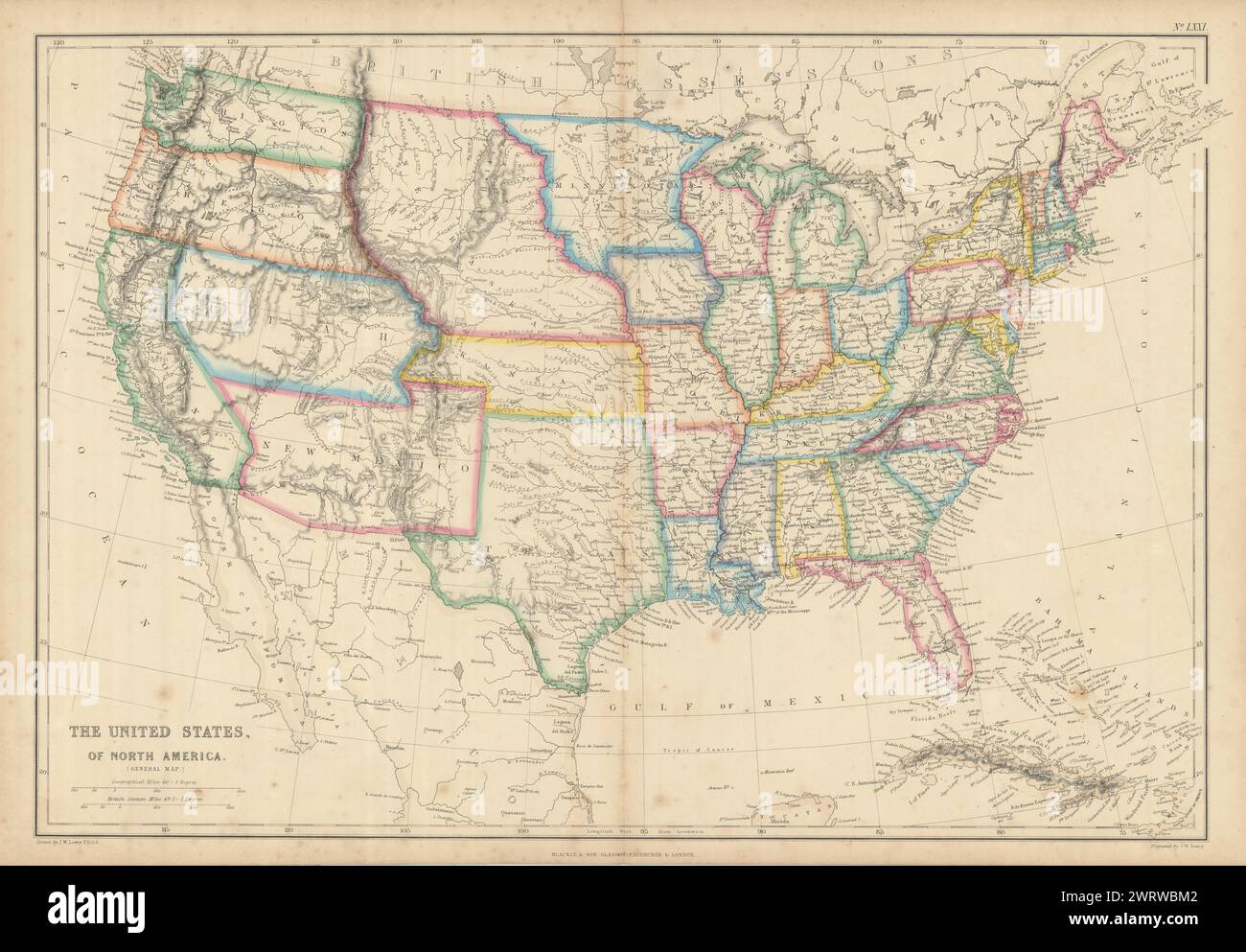
United States of North America. Early territorial boundaries. LOWRY 1860 map
Image details
Contributor:
Antiqua Print Gallery / Alamy Stock PhotoImage ID:
2WRWBM2File size:
312.5 MB (18.4 MB Compressed download)Releases:
Model - no | Property - noDo I need a release?Dimensions:
12537 x 8712 px | 106.1 x 73.8 cm | 41.8 x 29 inches | 300dpiDate taken:
1860Location:
USAMore information:
This image could have imperfections as it’s either historical or reportage.
The United States of North America (General Map). Artist/engraver/cartographer: Joseph Wilson Lowry. Provenance: "The Imperial Atlas of Modern Geography", under the supervision of W.G. Blackie PhD. Blackie and Son, Paternoster Row E.C. Glasgow and Edinburgh. Type: Antique engraved atlas map with original hand colour/color. Scarce double page map of the United States showing early territorial boundaries throughout the Transmississippi West. Nebraska Territory extends west to the Rocky Mountains and north to Canada. Oregon & Washington Territories extend from Nebraska to the Pacific. Washington Territory had been organized from the half of Oregon Territory north of 46° north and the Columbia River in 1853. The western half of Oregon Territory as shown was admitted as the thirty-third state, Oregon, in 1859 (the year prior to publication), with the remainder transferred to Washington Territory. Kansas, extends from Missouri to the Rocky Mountains. New Mexico and Utah run from California to (and beyond) the Rocky Mountains. An oversize Texas includes all of Indian Territory