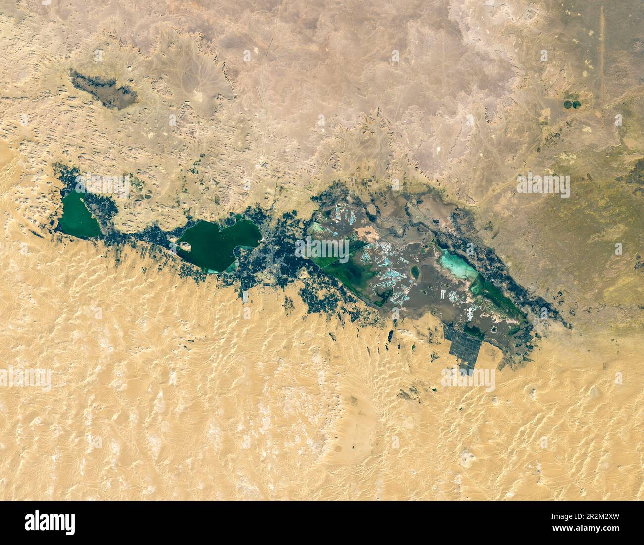
The Siwa Oasis is one of five large oases scattered across Egypt’s Western Desert, a vast sandy expanse that is part of the Sahara.
Image details
Contributor:
LWM/NASA/LANDSAT / Alamy Stock PhotoImage ID:
2R2M2XWFile size:
39.9 MB (2.4 MB Compressed download)Releases:
Model - no | Property - noDo I need a release?Dimensions:
4237 x 3291 px | 35.9 x 27.9 cm | 14.1 x 11 inches | 300dpiDate taken:
19 May 2023More information:
The salty Siwa Oasis is one of five large oases scattered across Egypt’s Western Desert, a vast sandy expanse that is part of the Sahara. Situated about 50 kilometers (30 miles) east of the Libyan border and nearly 600 kilometers (370 miles) west of Cairo, the region averages only about 10 millimeters (0.4 inches) of rainfall annually. However, owing to its unique geology, there is currently enough water to support agriculture, tourism, and salt harvesting operations. The oasis has sustained settlements dating as far back as ancient Egypt’s 26th dynasty in the 6th century B.C.E. Travelers to the area today can visit, among other ruins, the temple where Alexander the Great was said to be pronounced the son of the deity Amun. They may also delight in bobbing in the dense waters of its many salt ponds. The image above shows several lakes and nearby springs amid the arid environment. It was captured on January 23, 2023, by the Operational Land Imager-2 (OLI-2) on Landsat 9. The array of lakes exists here because of a tectonically formed depression that reaches depths of 20 meters (65 feet) below sea level. Surface water in the depression is supplied by springs that are fed by shallow groundwater, which in turn is supplied with water from the Nubian Sandstone Aquifer System (NSAS)—one of the largest aquifers in the world.