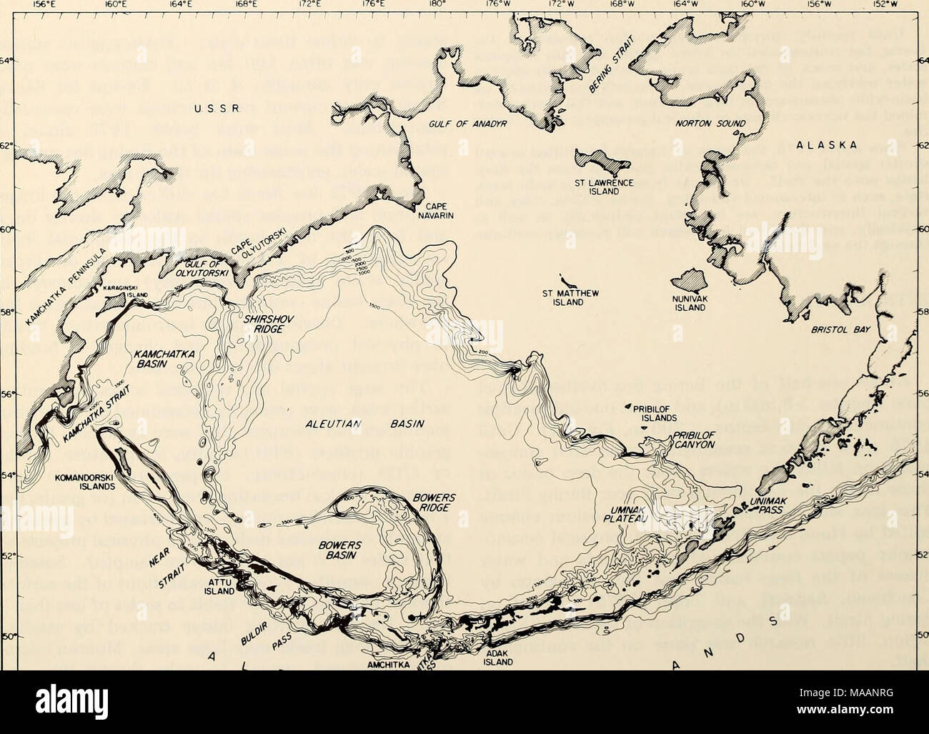
. The Eastern Bering Sea Shelf : oceanography and resources / edited by Donald W. Hood and John A. Calder . ALASKA J t I I J I L AMCHITKA 4<fe) ISLAND jif^V? I I I I I I 1 ; I 1 1 1 1 L. Figure 1-1. The Bering Sea: About one-half of the Bering Sea is abyssal plain at depths exceeding 3,500 m and about one-half continental shelf at depths less than 200 m. Recent work has concentrated on the shelf north of St. Lawrence Island and east of Nunivak Island/Pribilof Islands. This figure was prepared by Noel McGary for the atlas by Sayles et al. (1979).
RMID:Image ID:MAANRG
Image details
Contributor:
The Bookworm Collection / Alamy Stock PhotoImage ID:
MAANRGFile size:
14.3 MB (607.3 KB Compressed download)Releases:
Model - no | Property - noDo I need a release?Dimensions:
2633 x 1899 px | 22.3 x 16.1 cm | 8.8 x 6.3 inches | 300dpiMore information:
This image is a public domain image, which means either that copyright has expired in the image or the copyright holder has waived their copyright. Alamy charges you a fee for access to the high resolution copy of the image.
This image could have imperfections as it’s either historical or reportage.