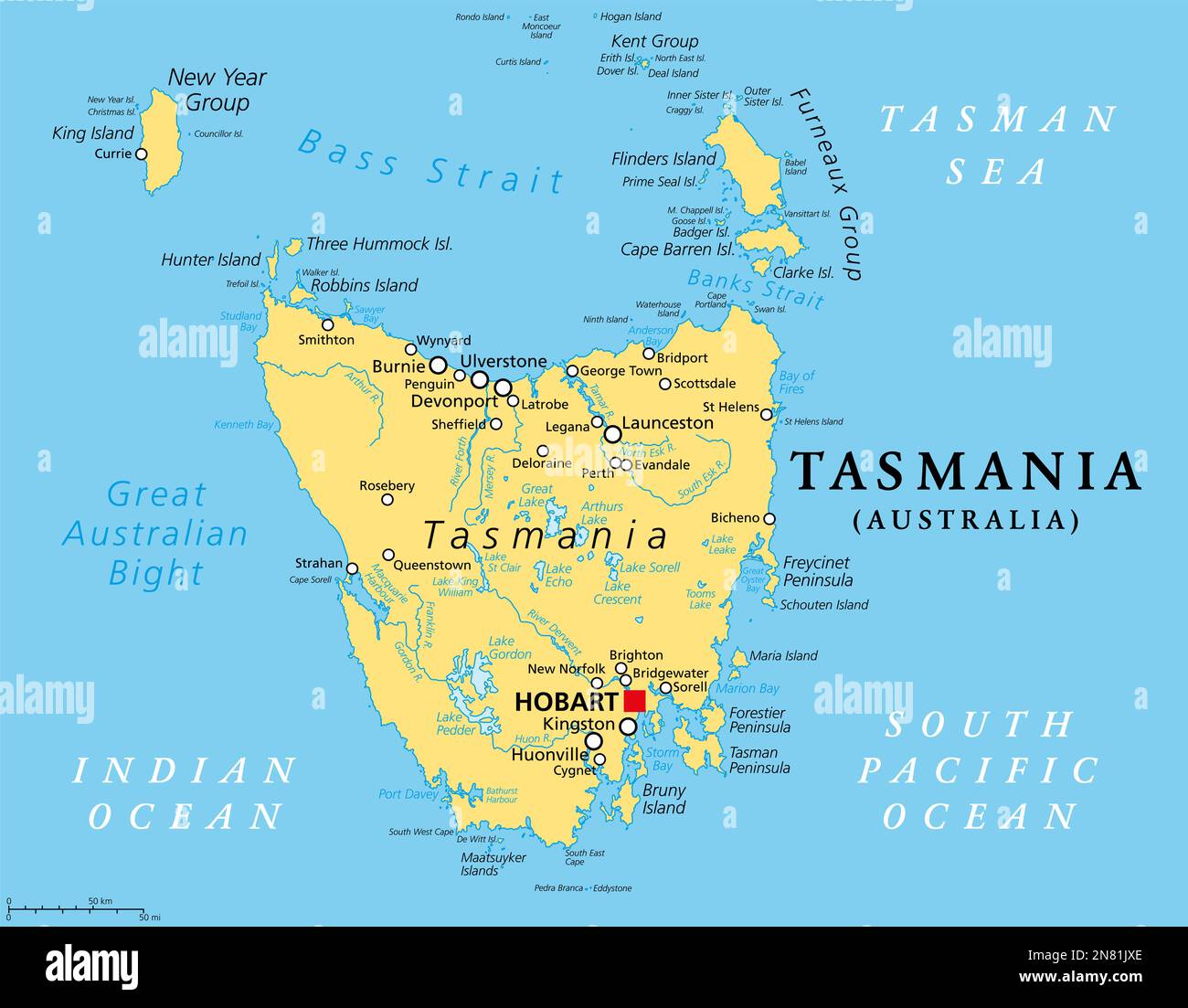
Tasmania, island state of Australia, political map. Located south of the Australian mainland, separated from it by Bass Strait.
RFID:Image ID:2N81JXE
Image details
Contributor:
Peter Hermes Furian / Alamy Stock PhotoImage ID:
2N81JXEFile size:
132.1 MB (1.9 MB Compressed download)Releases:
Model - no | Property - noDo I need a release?Dimensions:
7694 x 6000 px | 65.1 x 50.8 cm | 25.6 x 20 inches | 300dpiDate taken:
10 February 2023Location:
TasmaniaMore information:
Tasmania, island state of Australia, political map. Located south of the Australian mainland, separated from it by Bass Strait, surrounded by 1000 islands, with the capital and largest city Hobart.