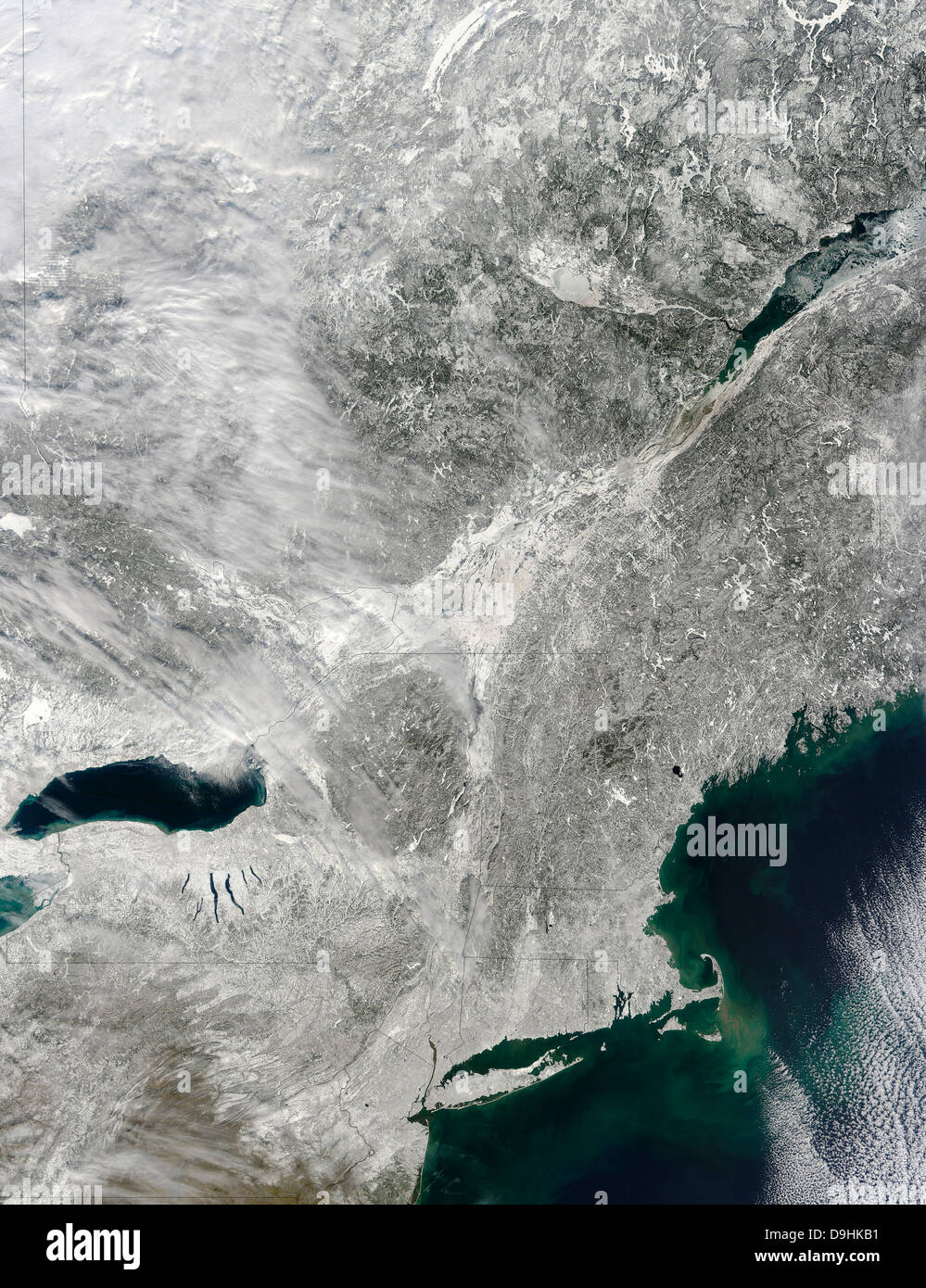
Satellite view of a large Nor'easter snow storm over United States.
Image details
Contributor:
Stocktrek Images, Inc. / Alamy Stock PhotoImage ID:
D9HKB1File size:
50.7 MB (4.4 MB Compressed download)Releases:
Model - no | Property - noDo I need a release?Dimensions:
3692 x 4800 px | 31.3 x 40.6 cm | 12.3 x 16 inches | 300dpiDate taken:
10 February 2013Photographer:
Stocktrek ImagesMore information:
The Moderate Resolution Imaging Spectroradiometer (MODIS) on NASA’s Terra satellite captured this natural-color image on February 10, 2013. Through a partial veil of thin clouds, MODIS could detect snow cover stretching from the East Coast westward past Lake Ontario. February 10, 2013 - A remarkably powerful blizzard brought heavy snow and strong winds to the northeastern portion of the United States. Snow cover stretches from the East Coast westward past Lake Ontario. A collision of cold air from Canada with moist air from the Gulf of Mexico brought snowfalls that extended from northern New Jersey through Maine. The storm system was a typical winter storm system pattern known as a nor‘easter,