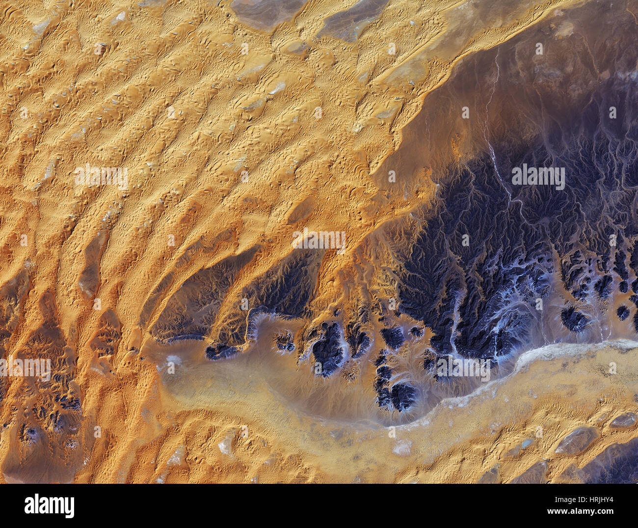
Sahara Desert, Algeria
Image details
Contributor:
Science History Images / Alamy Stock PhotoImage ID:
HRJHY4File size:
27.5 MB (2.4 MB Compressed download)Releases:
Model - no | Property - noDo I need a release?Dimensions:
3563 x 2700 px | 30.2 x 22.9 cm | 11.9 x 9 inches | 300dpiPhotographer:
Photo ResearchersMore information:
This image could have imperfections as it’s either historical or reportage.
This satellite image was captured over southeastern Algeria in the heart of the Sahara desert. In this image, a large area of rock appearing purple stretches across the right side of the image, with fluvial erosion patterns testament to an earlier time when the area received more rainfall. Today, this area sees an average of about 10 mm of rainfall per year. Wind-shaped sand dunes are visible on the left. The area at the bottom appears to be flat, with tiny specks of vegetation. Just south of this image lies the Tassili n'Ajjer National Park and UNESCO World Heritage Site, renowned for its 10, 000 year-old cave art. The drawings and engravings depict culture and the environment from a time when climatic conditions were more favorable to human occupation.