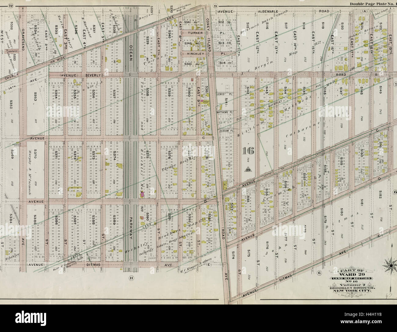
Part of Ward 29. Land Map Section, No. 16. Volume 2, Brooklyn Borough, New York City.
RMID:Image ID:H4H1Y8
Image details
Contributor:
Penta Springs Limited / Alamy Stock PhotoImage ID:
H4H1Y8File size:
65.7 MB (3.7 MB Compressed download)Releases:
Model - no | Property - noDo I need a release?Dimensions:
5469 x 4200 px | 46.3 x 35.6 cm | 18.2 x 14 inches | 300dpiDate taken:
12 August 2014Photographer:
ArtokoloroMore information:
This image could have imperfections as it’s either historical or reportage.
Part of Ward 29. Land Map Section, No. 16. Volume 2, Brooklyn Borough, New York City.