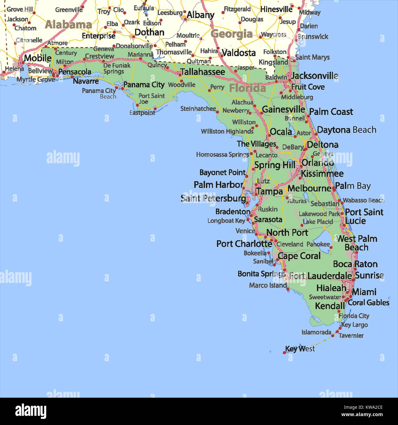
Map of Florida. Shows country borders, urban areas, place names, roads and highways. Projection: Mercator.
RFID:Image ID:KWA2CE
Image details
Contributor:
Michael Schmeling / Alamy Stock VectorImage ID:
KWA2CEReleases:
Model - no | Property - noDo I need a release?Date created:
25 December 2017