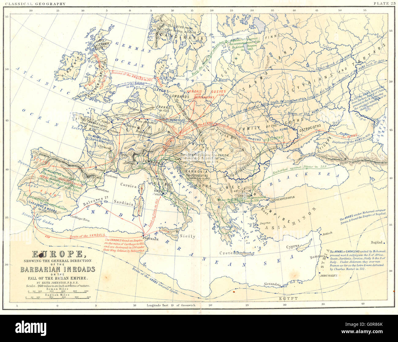
EUROPE: Barbarian Inroads, fall of Roman Empire, 1880 antique map
RFID:Image ID:G0R86K
Image details
Contributor:
Antiqua Print Gallery / Alamy Stock PhotoImage ID:
G0R86KFile size:
30 MB (2.1 MB Compressed download)Releases:
Model - no | Property - noDo I need a release?Dimensions:
3641 x 2881 px | 30.8 x 24.4 cm | 12.1 x 9.6 inches | 300dpiDate taken:
1880Location:
EuropeMore information:
This image could have imperfections as it’s either historical or reportage.
'Europe showing the general direction of the Barbarian Inroads, on the fall of the Roman Empire'. Artist/engraver/cartographer: Engraved by W & A.K. Johnston. Provenance: "School Atlas of Classical Geography by Alex Keith Johnston"; Published by W & A.K. Johnston, Edinburgh & London. Type: Colour antique map.