Alaskan Peninsula and the Aleutian Islands - satellite view
RMID:Image ID:DC733J
Image details
Contributor:
LWM/NASA/LANDSAT / Alamy Stock PhotoImage ID:
DC733JFile size:
60.8 MB (2.4 MB Compressed download)Releases:
Model - no | Property - noDo I need a release?Dimensions:
5200 x 4086 px | 44 x 34.6 cm | 17.3 x 13.6 inches | 300dpiMore information:
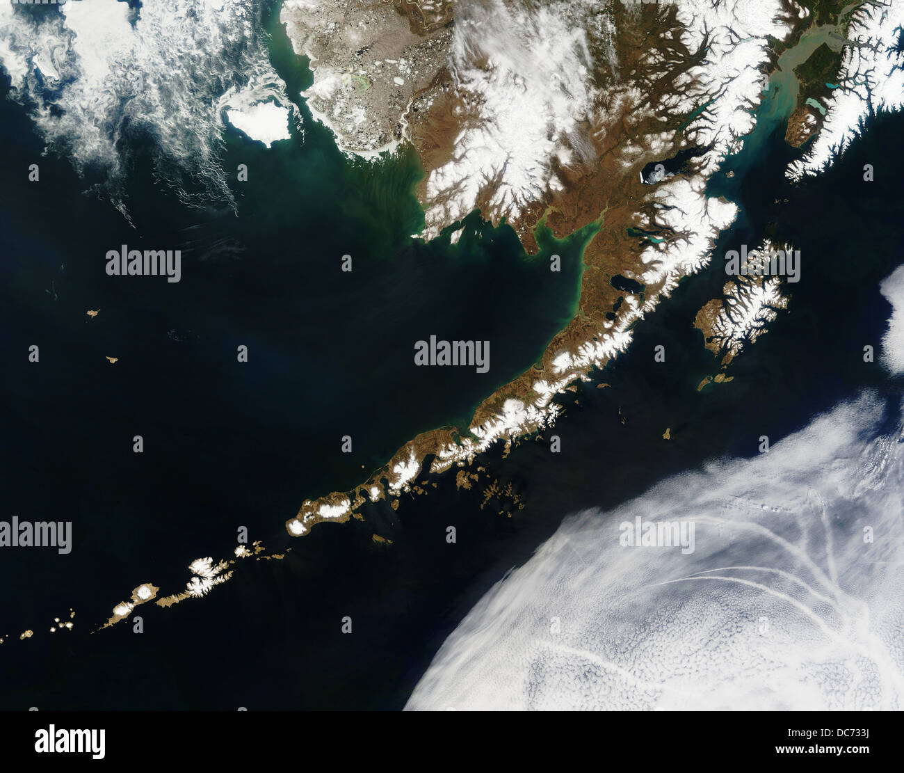
ALASKAN PENINSULA AND ALEUTIAN ISLANDS Credit: Jeff Schmaltz The Aleutian Islands and the Alaskan peninsula are shown in this image acquired by the MODIS on the Terra satellite, on May 25th, 2006. The Aleutians are a chain of more than 300 small volcanic islands forming an island arc in the Northern Pacific Ocean. They extend about 1, 200 miles westward from the Alaskan Peninsula. Nearly all of the islands are part of Alaska, but at the extreme western end of the archipelago are the small, geologically-related, but remote Komandorski Islands, which are considered part of Russia.