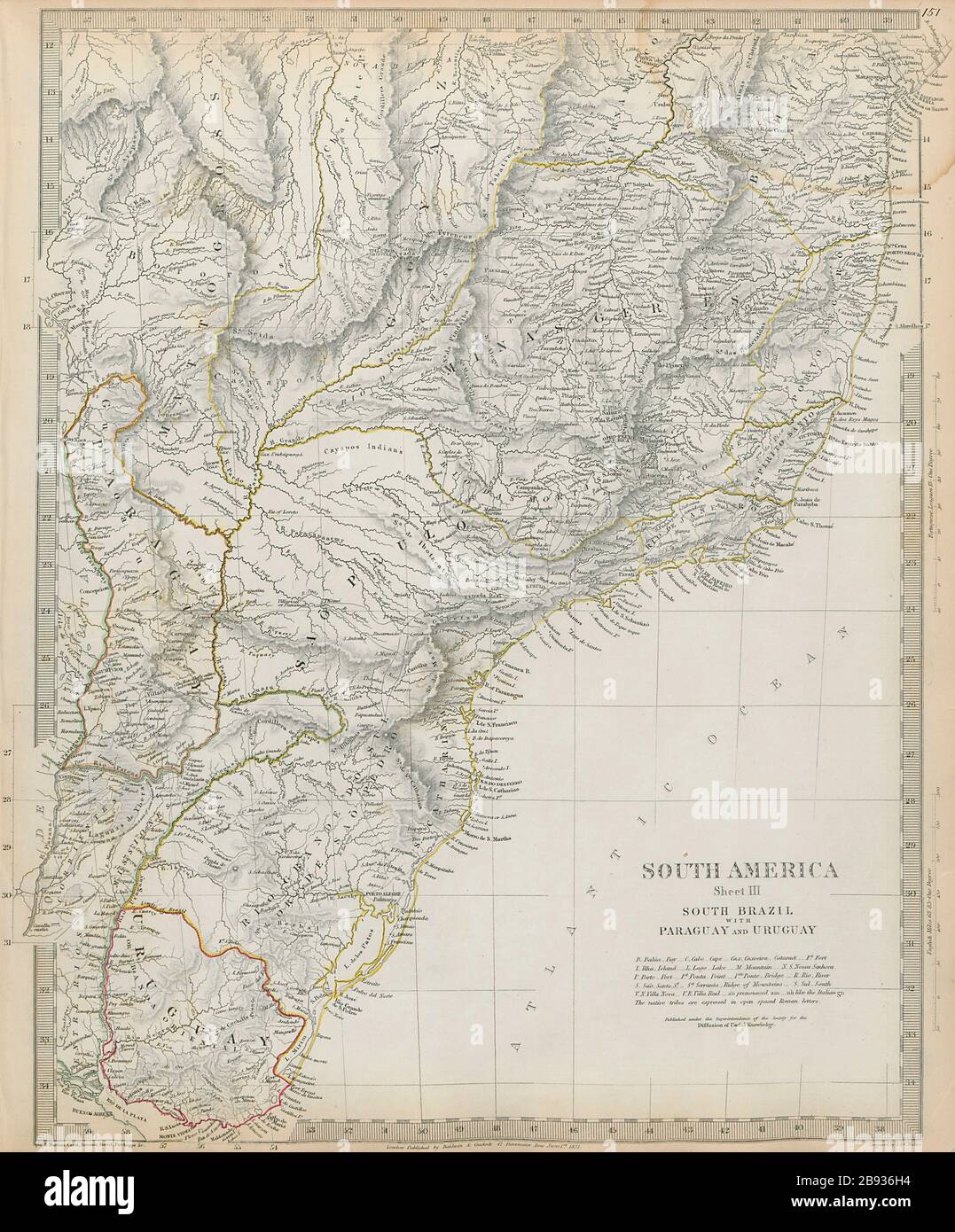
SOUTH BRAZIL with PARAGUAY & URUGUAY. Bahia Minas Gerais Sao Paolo SDUK 1844 map
RFID:Image ID:2B936H4
Image details
Contributor:
Antiqua Print Gallery / Alamy Stock PhotoImage ID:
2B936H4File size:
58.5 MB (3.4 MB Compressed download)Releases:
Model - no | Property - noDo I need a release?Dimensions:
4116 x 4965 px | 34.8 x 42 cm | 13.7 x 16.6 inches | 300dpiDate taken:
1844Location:
South AmericaMore information:
This image could have imperfections as it’s either historical or reportage.
SOUTH AMERICA, SHEET III., SOUTH BRAZIL WITH PARAGUAY AND URUGUAY. Artist/engraver/cartographer: Cartography by Spix & Martius, Roussin, Parchappe, Barral, Cazal; engraved by J & C Walker. Provenance: "Maps of the Society for the Diffusion of Useful Knowledge", published by Chapman & Hall, London, under the superintendance of the Society for the Diffusion of Useful Knowledge [SDUK Atlas]. Type: Antique steel engraved map with original outline hand colouring (coloring). The map includes some interesting brief anecdotes, eg "The Mate chiefly cultivated around Villa Rica"