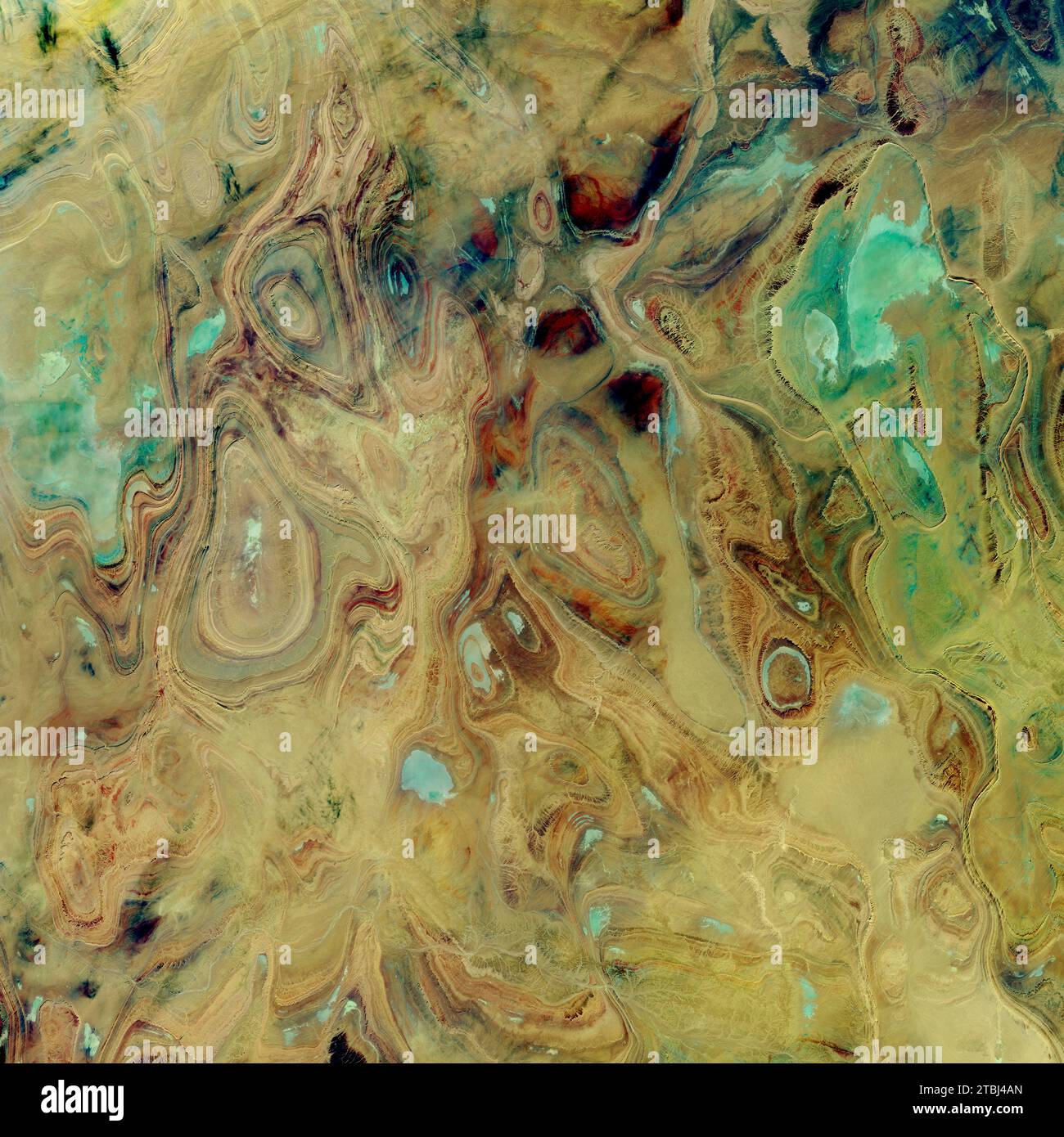
Satellite image of exposed sandstone strata across the Tanezrouft Basin in Algeria.
RFID:Image ID:2TBJ4AN
Image details
Contributor:
Stocktrek Images, Inc. / Alamy Stock PhotoImage ID:
2TBJ4ANFile size:
74.4 MB (4 MB Compressed download)Releases:
Model - no | Property - noDo I need a release?Dimensions:
5100 x 5100 px | 43.2 x 43.2 cm | 17 x 17 inches | 300dpiDate taken:
22 October 2017Photographer:
Stocktrek ImagesMore information:
This image is a public domain image, which means either that copyright has expired in the image or the copyright holder has waived their copyright. Alamy charges you a fee for access to the high resolution copy of the image.
October 22, 2017 - Satellite image showing concentric rings of exposed sandstone strata that create stunning patterns across the Tanezrouft Basin in Algeria. The sandstone canyons in this region have walls that rise as high as 500 meters (1, 600 feet), and salt flats can be found in their lower reaches. The flats indicate that water played a role in sculpting this landscape.