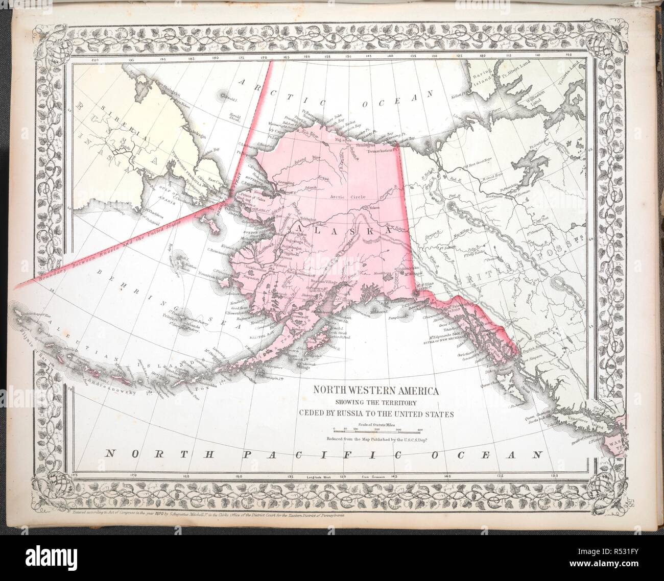
North Western America showing the territory ceded by Russia to the United States. Mitchell's new general atlas, containing maps of the various countries of the world, plans of cities, etc.: embraced in sixty-three quarto maps, forming a series of one hundred maps and plans, together with valuable statistic tables. Philadelphia : published by S. Augustus Mitchell, Jr., No. 31 South Sixth Street, 1870. Source: Maps.C.49.e.69 plate 58. Author: Mitchell jr., Samuel Augustus.
RMID:Image ID:R531FY
Image details
Contributor:
Album / British Library / Alamy Stock PhotoImage ID:
R531FYFile size:
155.9 MB (6.6 MB Compressed download)Releases:
Model - no | Property - noDo I need a release?Dimensions:
8220 x 6627 px | 69.6 x 56.1 cm | 27.4 x 22.1 inches | 300dpiMore information:
This image could have imperfections as it’s either historical or reportage.