New Zealand, satellite image
RFID:Image ID:AD42KA
Image details
Contributor:
Stocktrek Images, Inc. / Alamy Stock PhotoImage ID:
AD42KAFile size:
48 MB (2.4 MB Compressed download)Releases:
Model - no | Property - noDo I need a release?Dimensions:
3648 x 4600 px | 30.9 x 38.9 cm | 12.2 x 15.3 inches | 300dpiPhotographer:
Stocktrek ImagesMore information:
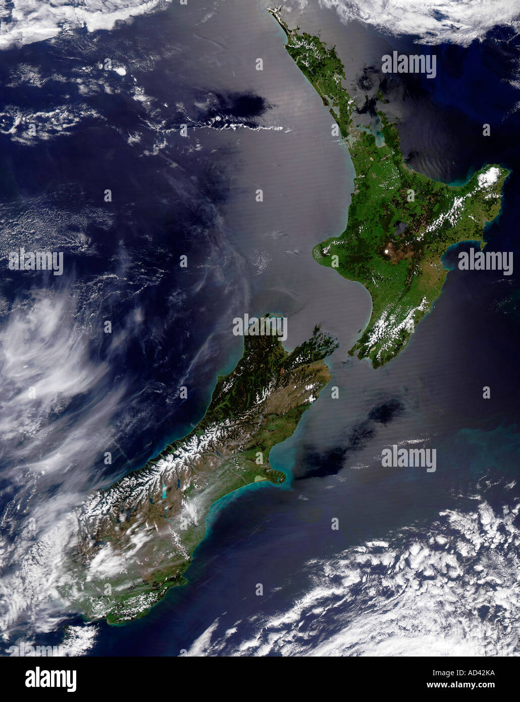
This stunning true-color image provides a rare, cloud-free look at the island nation of New Zealand, including all of North and part of South Island. This scene was acquired by the Aqua MODIS instrument on December 27, 2004. New Zealand is situated in the South Pacific Ocean, roughly 2, 000 km (1, 250 miles) southeast of Australia. Wellington, the capital of New Zealand, is located on the southern tip of the North Island, looking across Cook Strait toward South Island. Surrounding the islands like a silver halo is a swath of sunglint, while north of the Bay of Plenty in the Pacific Ocean is a blue cloud of phytoplankton.