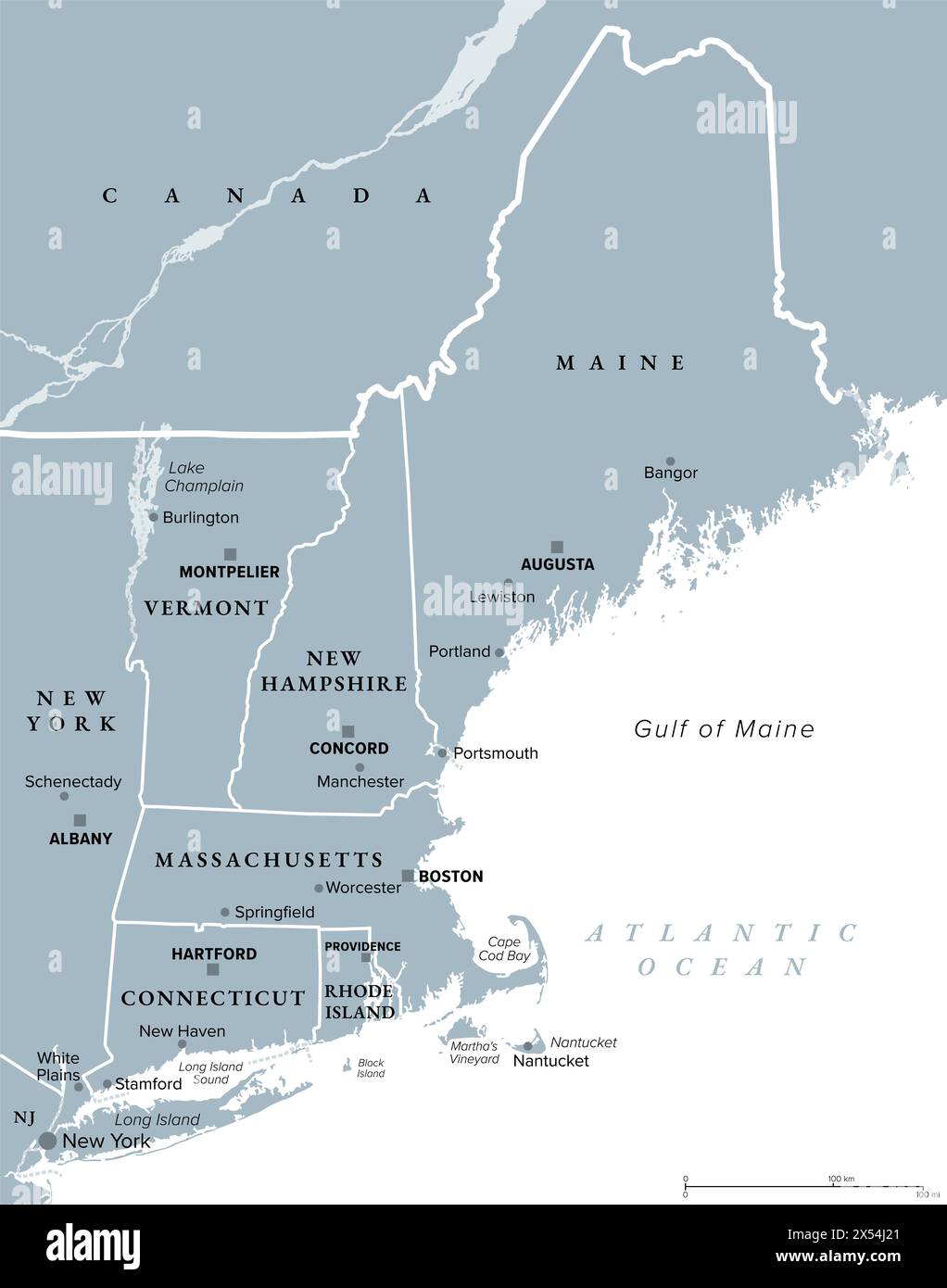
New England, a region of the United States, gray political map. Maine, Vermont, New Hampshire, Massachusetts, Rhode Island and Connecticut.
RFID:Image ID:2X54J21
Image details
Contributor:
Peter Hermes Furian / Alamy Stock PhotoImage ID:
2X54J21File size:
130.9 MB (1 MB Compressed download)Releases:
Model - no | Property - noDo I need a release?Dimensions:
6000 x 7627 px | 50.8 x 64.6 cm | 20 x 25.4 inches | 300dpiDate taken:
7 May 2024Location:
New EnglandMore information:
New England, a region of the United States, gray political map. Maine, Vermont, New Hampshire, Massachusetts, Rhode Island and Connecticut with Capitals. Bordered by Mid-Atlantic region and by Canada.