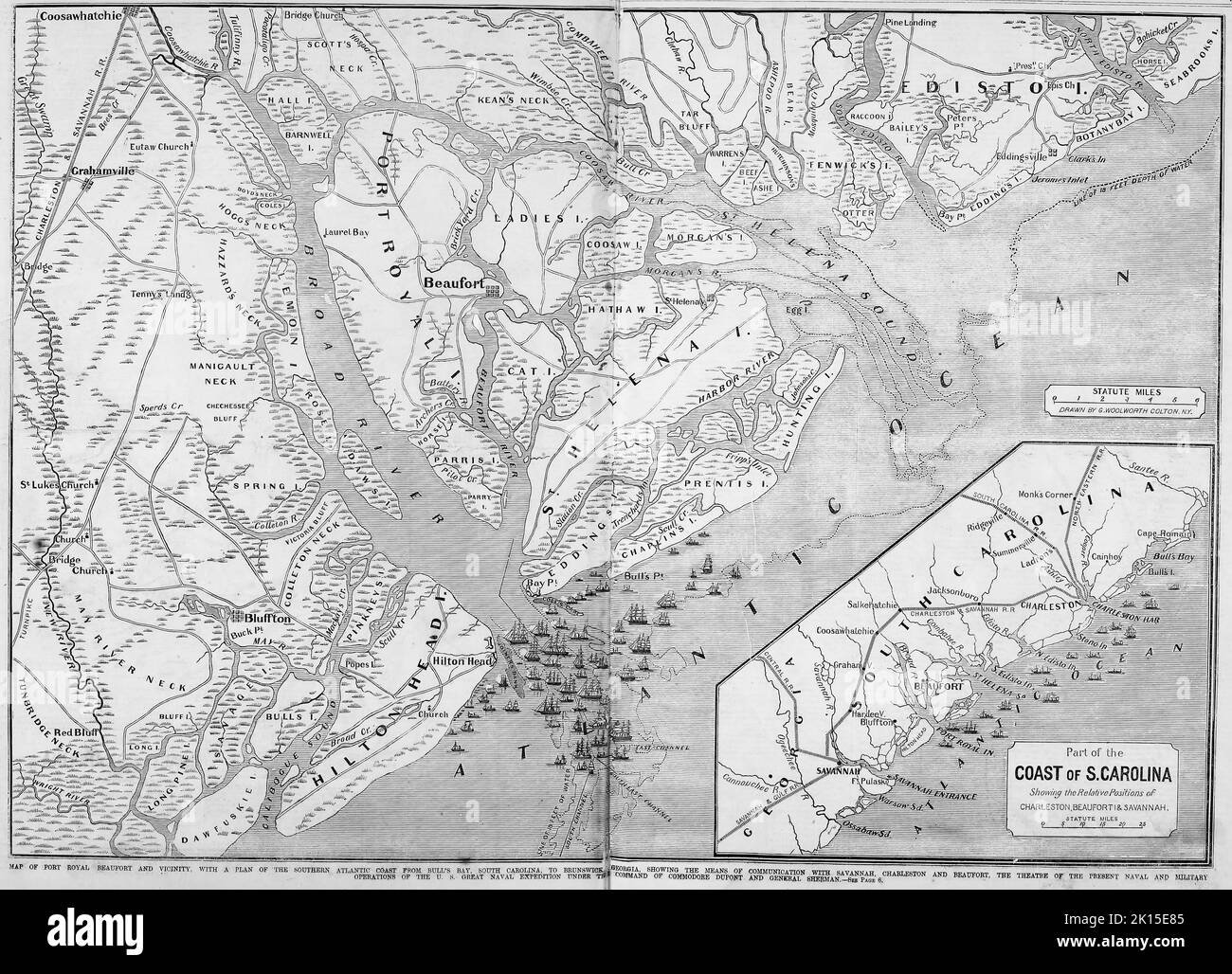
Map of Port Royal Beaufort and vicinity, with a plan of the Southern Atlantic coast from Bull's Bay, South Carolina, to Brunswick, Georgia, showing the means of communication with Savannah, Charleston, and Beaufort, the theatre of the present naval and military operations of the U. S. Great Naval Expedition under the command of Commode Samuel Francis Du Pont and General William Tecumseh Sherman. 1861. 19th century American Civil War illustration from Frank Leslie's Illustrated Newspaper
RFID:Image ID:2K15E85
Image details
Contributor:
Mouseion Archives / Alamy Stock PhotoImage ID:
2K15E85File size:
152.3 MB (10.4 MB Compressed download)Releases:
Model - no | Property - noDo I need a release?Dimensions:
8588 x 6200 px | 72.7 x 52.5 cm | 28.6 x 20.7 inches | 300dpiDate taken:
15 September 2022More information:
This image is a public domain image, which means either that copyright has expired in the image or the copyright holder has waived their copyright. Alamy charges you a fee for access to the high resolution copy of the image.
This image could have imperfections as it’s either historical or reportage.