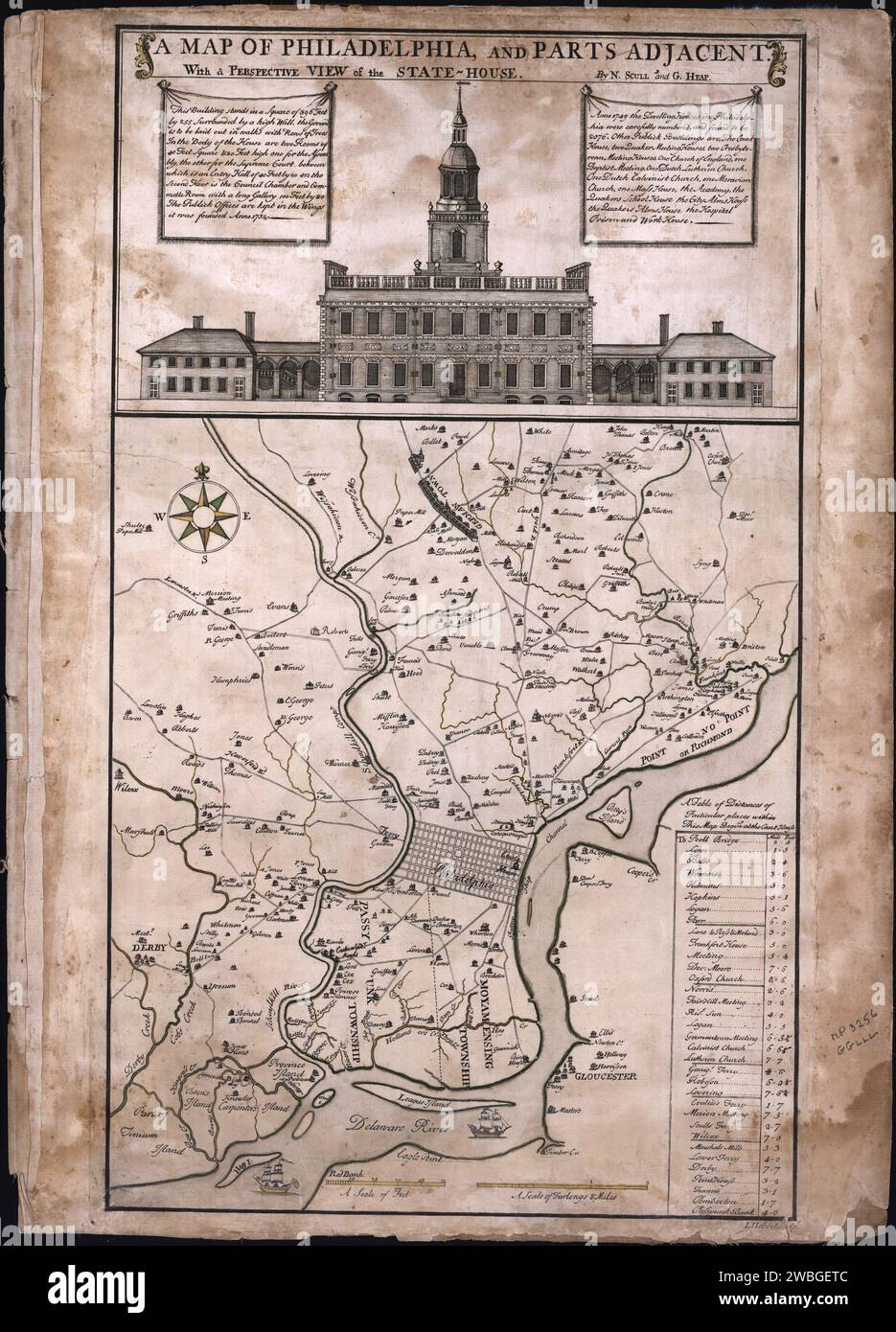
Map of Philadelphia, and Parts Adjacent, With a Perspective View of the State-House. mid 18th century map by Nicolas Scull and George Heap illustrates the roads, canals, and important landowners of Philadelphia and its vicinity.
RMID:Image ID:2WBGETC
Image details
Contributor:
EMU history / Alamy Stock PhotoImage ID:
2WBGETCFile size:
85.3 MB (5 MB Compressed download)Releases:
Model - no | Property - noDo I need a release?Dimensions:
4633 x 6438 px | 39.2 x 54.5 cm | 15.4 x 21.5 inches | 300dpiDate taken:
2 June 2005More information:
This image is a public domain image, which means either that copyright has expired in the image or the copyright holder has waived their copyright. Alamy charges you a fee for access to the high resolution copy of the image.
This image could have imperfections as it’s either historical or reportage.