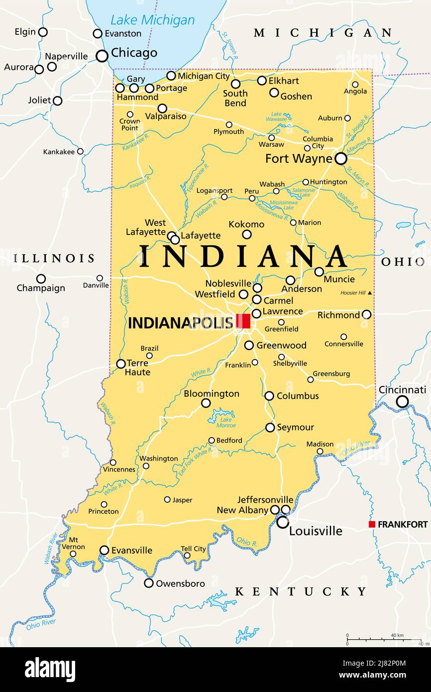
Indiana, IN, political map, with the capital Indianapolis, and most important cities, rivers and lakes. State in Midwestern region of United States.
RFID:Image ID:2J82P0M
Image details
Contributor:
Peter Hermes Furian / Alamy Stock PhotoImage ID:
2J82P0MFile size:
154.5 MB (2.5 MB Compressed download)Releases:
Model - no | Property - noDo I need a release?Dimensions:
6000 x 9000 px | 50.8 x 76.2 cm | 20 x 30 inches | 300dpiDate taken:
12 May 2022Location:
IndianaMore information:
Indiana, IN, political map, with the capital Indianapolis, and most important cities, rivers and lakes. State in the Midwestern region of the United States of America, nicknamed The Hoosier State.