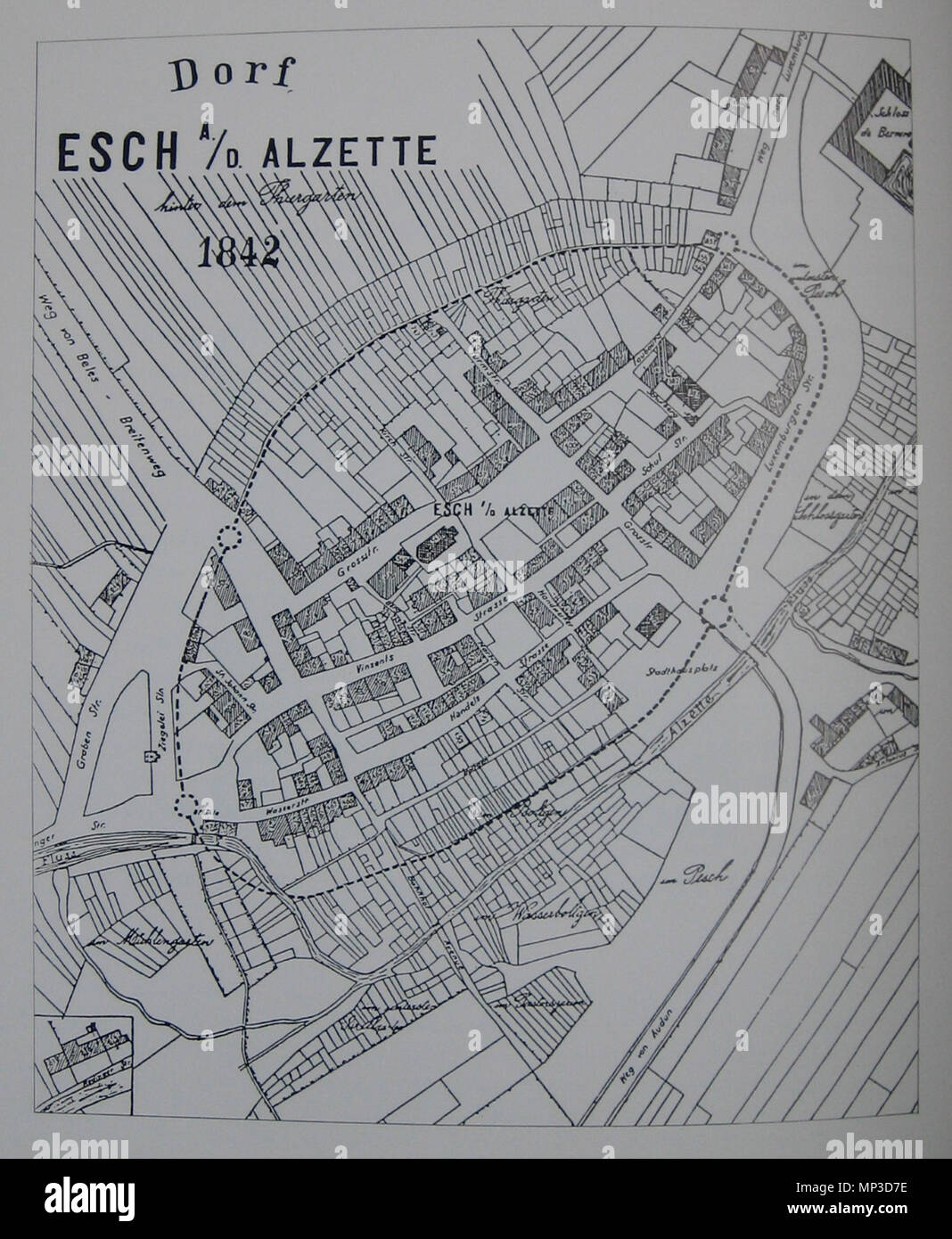
. English: Map of the town of Esch-sur-Alzette (according to the Plan cadastral of 1842). The dotted lines indicate the position of the former city wall and towers. 1870. François Xavier Wurth-Paquet (1801-1885) 850 Map Esch-sur-Alzette 1842
RMID:Image ID:MP3D7E
Image details
Contributor:
The Picture Art Collection / Alamy Stock PhotoImage ID:
MP3D7EFile size:
14.3 MB (705.9 KB Compressed download)Releases:
Model - no | Property - noDo I need a release?Dimensions:
2027 x 2466 px | 34.3 x 41.8 cm | 13.5 x 16.4 inches | 150dpiDate taken:
29 December 2010More information:
This image is a public domain image, which means either that copyright has expired in the image or the copyright holder has waived their copyright. Alamy charges you a fee for access to the high resolution copy of the image.
This image could have imperfections as it’s either historical or reportage.