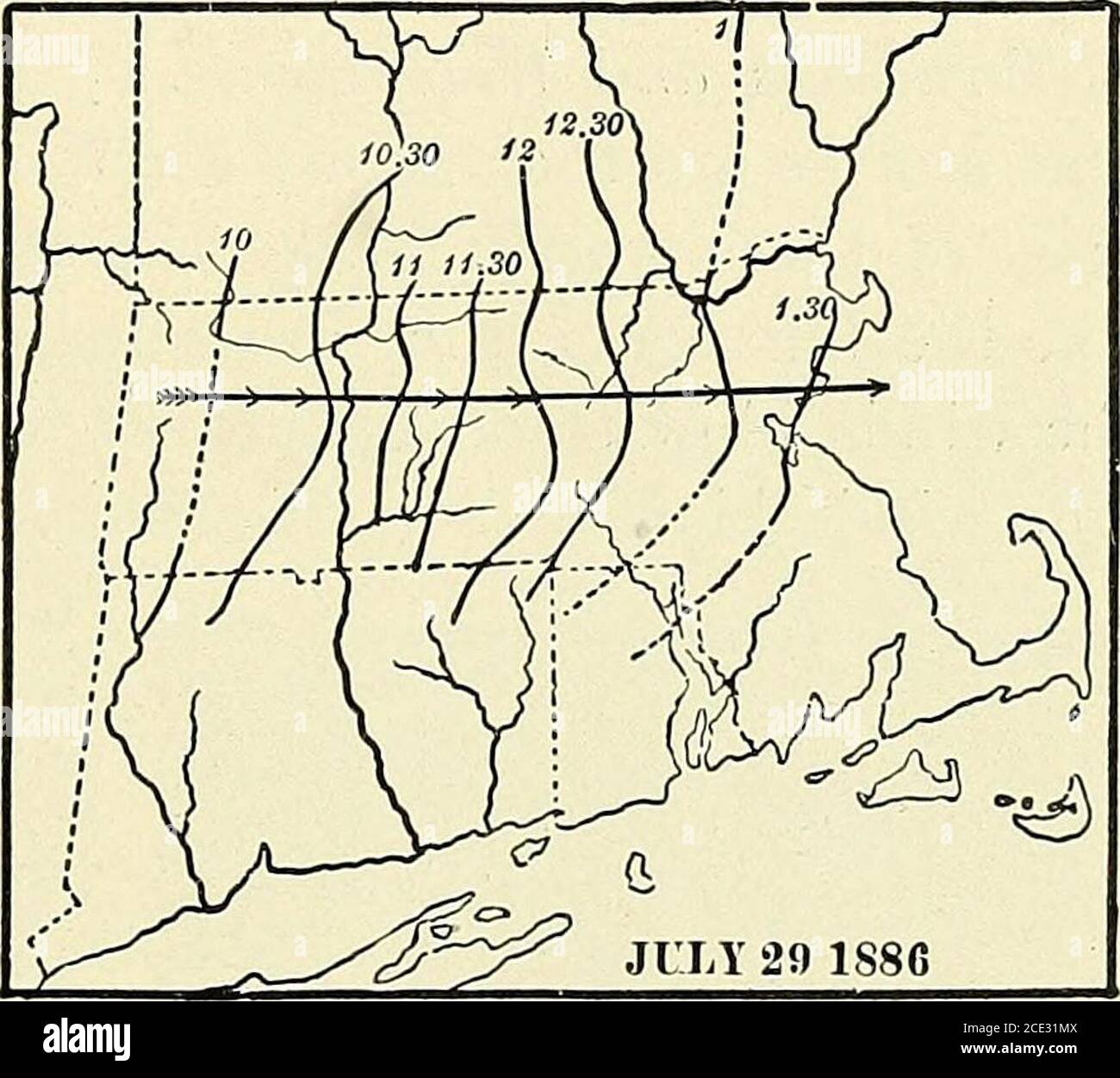
. Elementary physical geography . Fig. 50.Photograph of a distant thunderstorm. STORMS. 103 that of an anvil (Fig. 50). At high elevations, the cloudsextend out in front of the storm, marking the upper outflowof the air. The great elevation of the cloud mass is due tothe fact that the air continues to rise to these heights, andthe vapor to condense as the temperature descends. Most of our thunderstorms are a part of moderatelydeveloped cyclonic disturbances, and they occur most com-monly in the southern part of these storms. Here warmmoist air is being drawnin toward the stormcenter, and hence
Image details
Contributor:
Reading Room 2020 / Alamy Stock PhotoImage ID:
2CE31MXFile size:
7.1 MB (313.5 KB Compressed download)Releases:
Model - no | Property - noDo I need a release?Dimensions:
1672 x 1494 px | 28.3 x 25.3 cm | 11.1 x 10 inches | 150dpiMore information:
This image is a public domain image, which means either that copyright has expired in the image or the copyright holder has waived their copyright. Alamy charges you a fee for access to the high resolution copy of the image.
This image could have imperfections as it’s either historical or reportage.
. Elementary physical geography . Fig. 50.Photograph of a distant thunderstorm. STORMS. 103 that of an anvil (Fig. 50). At high elevations, the cloudsextend out in front of the storm, marking the upper outflowof the air. The great elevation of the cloud mass is due tothe fact that the air continues to rise to these heights, andthe vapor to condense as the temperature descends. Most of our thunderstorms are a part of moderatelydeveloped cyclonic disturbances, and they occur most com-monly in the southern part of these storms. Here warmmoist air is being drawnin toward the stormcenter, and hence theconditions favoring thedevelopment of thun-der-storms are pro-duced. As the stormcenter progresses, thearea in which thunder-storms may develop al-so moves eastward, andany single storm will befound to have the samepath (Fig. 51). Somethunderstorms havepassed entirely. Fig. 51.Progression of a thunderstorm in Massachu-setts. The figures represent the hours atwhich the storm front reached the placesindicated by the line. across New England, while others die out after traveling a fewmiles. Some pass over a broad path, while the width ofothers is only a few hundred yards. When the path is long, the storm may continue into the night; and most night thun-derstorms have originated, during the preceding afternoon, at some point far to the west. The rate of progression isusually not greater than 40 or 50 miles an hour. In the thunderstorm, after the first violent squall, thatusually blows out from the base of the storm, the winds 104 PHYSICAL GEOGRAPHY. are generally not violent; but there is a steady and oftenheavy downfall of rain, with accompanying thunder andlightning. In some cases the downpour of rain is exces-sive ; and among the mountains of the west, there are oftensuch torrents of water that the name cloudburst is given tothem. The name is certainly