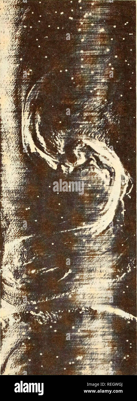
. Collected reprints, Essa Institute for Oceanography. Oceanography Periodicals.. Fig. 6âInfrared line scan photography of an eddy about four miles in diam- eter, 200 miles east of Cape Cod taken from aircraft. Spectral range 8-14 mi- crons; length of area shown is 11 nautical miles. White spots are mal- functions of scanner. Light tones are warmer than dark tones. transparent convection cells over the North Atlantic and Gulf Stream also have been recorded. The apparent temperature discontinuities of such cells are only about 1° C and the horizontal dimensions range from 1 to 10 miles. What's

Image details
Contributor:
The Book Worm / Alamy Stock PhotoImage ID:
REGWGJFile size:
7.1 MB (538.1 KB Compressed download)Releases:
Model - no | Property - noDo I need a release?Dimensions:
957 x 2611 px | 8.1 x 22.1 cm | 3.2 x 8.7 inches | 300dpiMore information:
This image is a public domain image, which means either that copyright has expired in the image or the copyright holder has waived their copyright. Alamy charges you a fee for access to the high resolution copy of the image.
This image could have imperfections as it’s either historical or reportage.
. Collected reprints, Essa Institute for Oceanography. Oceanography Periodicals.. Fig. 6âInfrared line scan photography of an eddy about four miles in diam- eter, 200 miles east of Cape Cod taken from aircraft. Spectral range 8-14 mi- crons; length of area shown is 11 nautical miles. White spots are mal- functions of scanner. Light tones are warmer than dark tones. transparent convection cells over the North Atlantic and Gulf Stream also have been recorded. The apparent temperature discontinuities of such cells are only about 1° C and the horizontal dimensions range from 1 to 10 miles. What's needed for current studies? We know little about the meanders of the Gulf Stream. We are not able to predict the size, location or likelihood of its meanders; we do not know whether the meander dynamics are the same for both sides of the Gulf Stream. We need a multi-sensor surveillance system, including microwave components with cloud penetra- tion capability to supply raw data and surface-recorded data to aid us in interpretation. A time-sequence charting of the boundaries of sur- face currents as to shape size and location will contrib- ute much toward understanding of total dynamics and at the same time provide valuable data for the shipping industry. The capability of aircraft systems to detect an ocean eddy is illustrated in Fig. 6. Reasonably, such detection should be followed up by sending a ship to make a sur- face and subsurface profile as the aircraft is collecting such imagery. Themal profiles generated from micronsi- tometer scans across the image can be correlated with a ship-towed thermistor for calibration and comparison. Time-sequencing by the aircraft at 15 to 20-minute in- tervals could reveal motion within the eddy, etc. Exciting programs lie ahead The present aircraft-ship experimentation will con- tinue; then in the summer of 1969, the ESSA Barbados Oceanographic and Meteorological Experiment will be carried out in the eastern Caribbean vicinity. This e