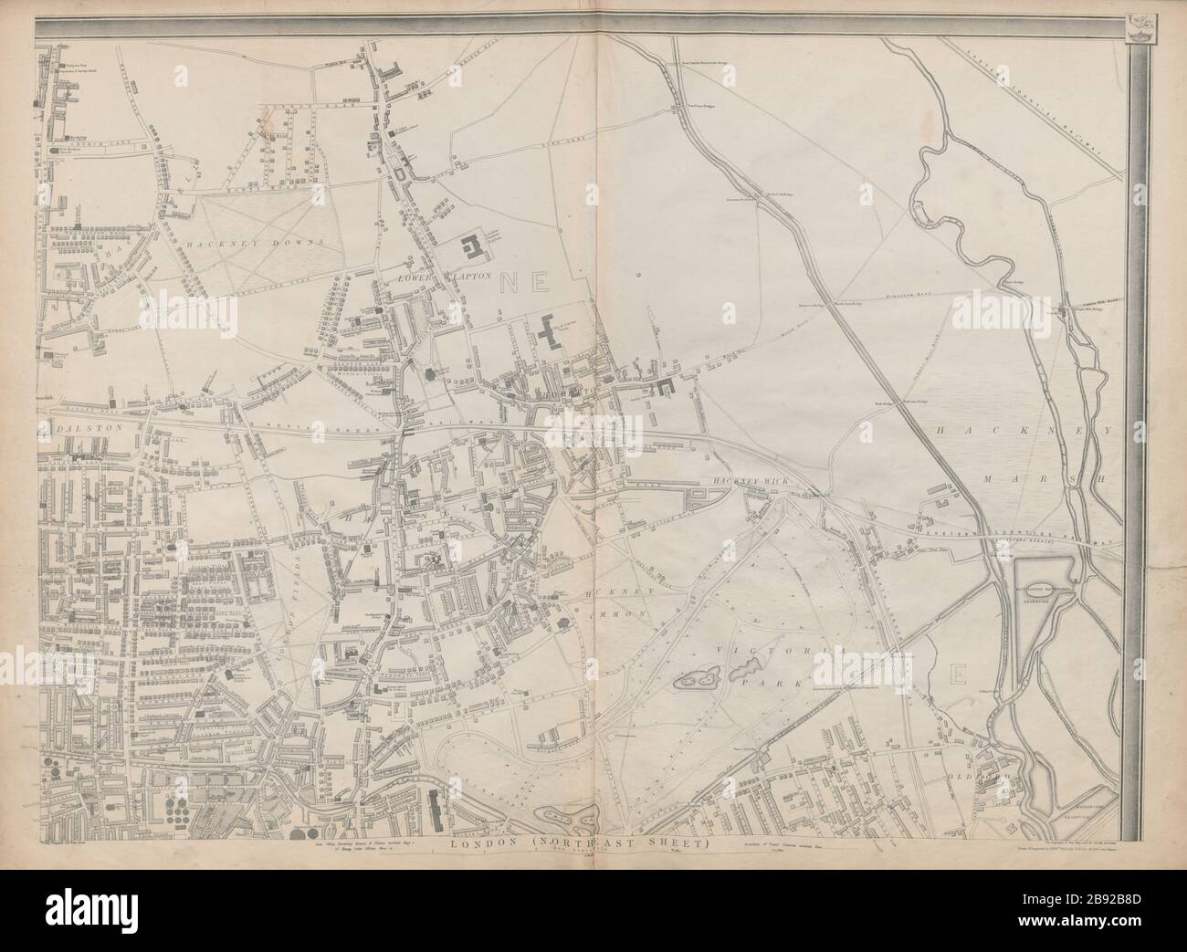
'CASSELLS LONDON NE. Hackney Old Ford Dalston Clapton Homerton. WELLER 1863 map
RFID:Image ID:2B92B8D
Image details
Contributor:
Antiqua Print Gallery / Alamy Stock PhotoImage ID:
2B92B8DFile size:
232.3 MB (6.2 MB Compressed download)Releases:
Model - no | Property - noDo I need a release?Dimensions:
10522 x 7717 px | 89.1 x 65.3 cm | 35.1 x 25.7 inches | 300dpiDate taken:
1863Location:
LondonMore information:
This image could have imperfections as it’s either historical or reportage.
Cassell's Map of London (North East Sheet). Artist/engraver/cartographer: Drawn & Engraved by Edwd. Weller. Provenance: "Cassell's Complete Atlas" (a.k.a. "The Weekly Dispatch Atlas"), Published by Cassell, Petter and Galpin, London (Dispatch London maps) [Cassell's Weekly Dispatch Atlas]. Type: Antique map with original outline colour. Victoria Park is shown at the bottom of the map; Hackney Downs towards the top left hand corner, London Fields towards the bottom left hand corner, and Hackney Marshes occupy the upper right hand part of the map.