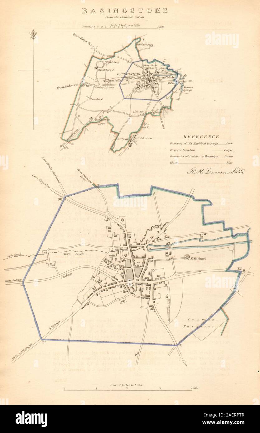
BASINGSTOKE borough/town plan. BOUNDARY COMMISSION. Hampshire. DAWSON 1837 map
Image details
Contributor:
Antiqua Print Gallery / Alamy Stock PhotoImage ID:
2AERPTRFile size:
26.1 MB (851.3 KB Compressed download)Releases:
Model - no | Property - noDo I need a release?Dimensions:
2420 x 3768 px | 20.5 x 31.9 cm | 8.1 x 12.6 inches | 300dpiDate taken:
1837Location:
HampshireMore information:
This image could have imperfections as it’s either historical or reportage.
Basingstoke. Artist/engraver/cartographer: Robert K. Dawson Lieut. R.E. . Provenance: "Reports of the Commissioners appointed to report and advise upon the Boundaries and Wards of certain Boroughs and Corporate Towns in England and Wales. Part I." Presented by His Majesty's command /060117/ [Reform Act boundary report]. Type: Antique lithographic map with original hand colour. The map was published a few years after the 1832 Reform Act, within the 1837 Boundary Commission report to the House of Commons. Most of these maps shows the existing municipal borough boundaries in green, the parliamentary boroughs (if different) in red, and the proposed boundary in purple. The boundaries were used to determine the parliamentary consituencies at the time.