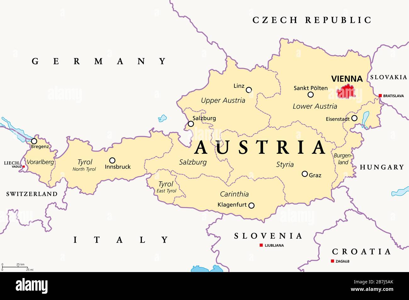
Austria, political map, with the capital Vienna, nine federated states and their capitals. With borders and the neighbor countries. English labeling.
RFID:Image ID:2B7J5AK
Image details
Contributor:
Peter Hermes Furian / Alamy Stock PhotoImage ID:
2B7J5AKFile size:
154.5 MB (1.3 MB Compressed download)Releases:
Model - no | Property - noDo I need a release?Dimensions:
9000 x 6000 px | 76.2 x 50.8 cm | 30 x 20 inches | 300dpiDate taken:
16 March 2020Location:
AustriaMore information:
Austria, political map, with the capital Vienna, nine federated states and their capitals. With borders and the neighbor countries. English labeling. Illustration.