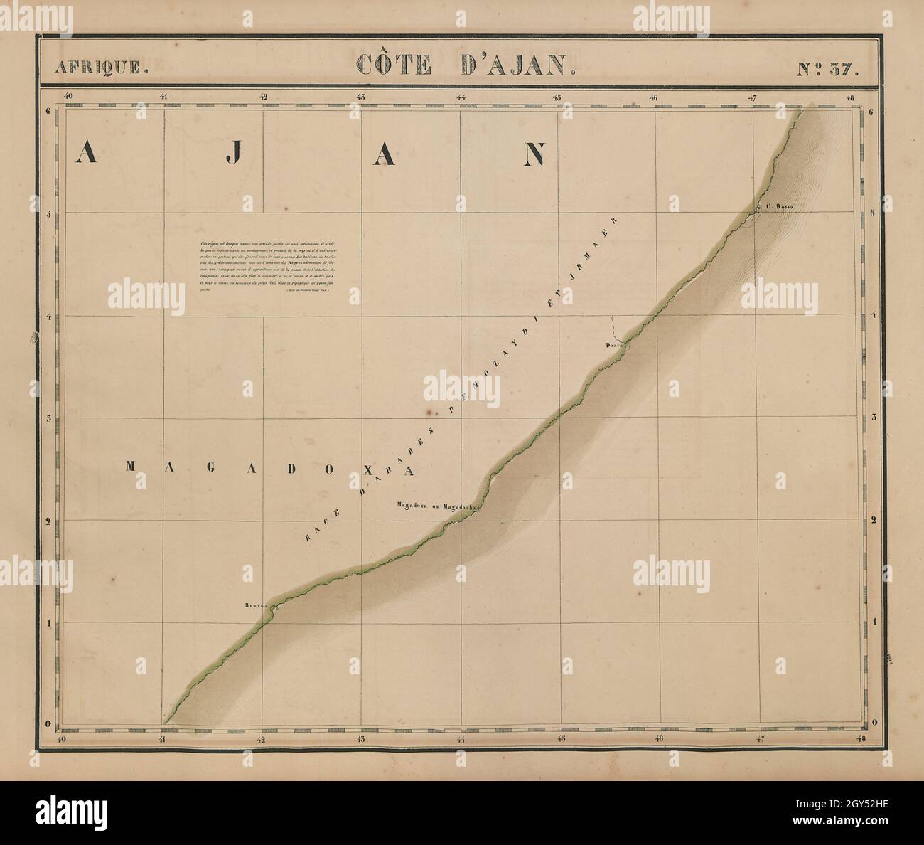
Afrique. Côte d'Ajan #37. Somalia Ethiopia Mogadishu. VANDERMAELEN 1827 map
Image details
Contributor:
Antiqua Print Gallery / Alamy Stock PhotoImage ID:
2GY52HEFile size:
126.1 MB (3.2 MB Compressed download)Releases:
Model - no | Property - noDo I need a release?Dimensions:
7222 x 6102 px | 61.1 x 51.7 cm | 24.1 x 20.3 inches | 300dpiDate taken:
1827Location:
SomaliaMore information:
This image could have imperfections as it’s either historical or reportage.
Afrique - Côte d'Ajan - No. 37. Artist/engraver/cartographer: Philippe Marie Guillaume Vandermaelen. Lithography by Henri Ode. Provenance: "Atlas Universel de Geographie Physique, Politique, Statistique et Mineralogique", dresse par Ph. Vandermaelen - Premiere partie - Europe. Bruxelles. [This landmark atlas is remarkable as the first atlas to have been produced using the then new printing process of lithography. It is also the first atlas to show the whole world in maps using a large uniform scale; in total the 380 conically projected sheets of maps are designed to be joined into a three dimensional terrestrial globe with a diameter of approximately 7.75 metres (25 feet).]. Type: Antique folio-sized lithographic atlas map, hand coloured in outline, on conical projection. This map was published within the first atlas ever to be printed using lithography, and also the first to be printed on a uniform scale. Southern Somalia and Eastern Ethiopia. Mogadishu