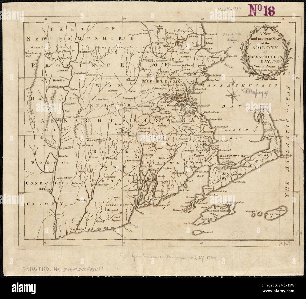
A new and accurate map of the colony of Massachusets Bay, in North America, from a late survey. Covers eastern Massachusetts, Rhode Island, eastern Connecticut, and small portions of New Hampshire and Vermont. Relief shown pictorially. From Universal magazine of knowledge and pleasure, vol. 66, Dec. 1780, opposite p. 281. Prime meridian: Ferro... New and accurate map of the colony of Massachusetts Bay. New and accurate map of the colony of Massachusetts Bay, Massachusetts Rhode Island Connecticut
RMID:Image ID:2M5X15W
Image details
Contributor:
LM/BT / Alamy Stock PhotoImage ID:
2M5X15WFile size:
32.2 MB (1.7 MB Compressed download)Releases:
Model - no | Property - noDo I need a release?Dimensions:
3526 x 3195 px | 29.9 x 27.1 cm | 11.8 x 10.7 inches | 300dpiMore information:
This image is a public domain image, which means either that copyright has expired in the image or the copyright holder has waived their copyright. Alamy charges you a fee for access to the high resolution copy of the image.
This image could have imperfections as it’s either historical or reportage.