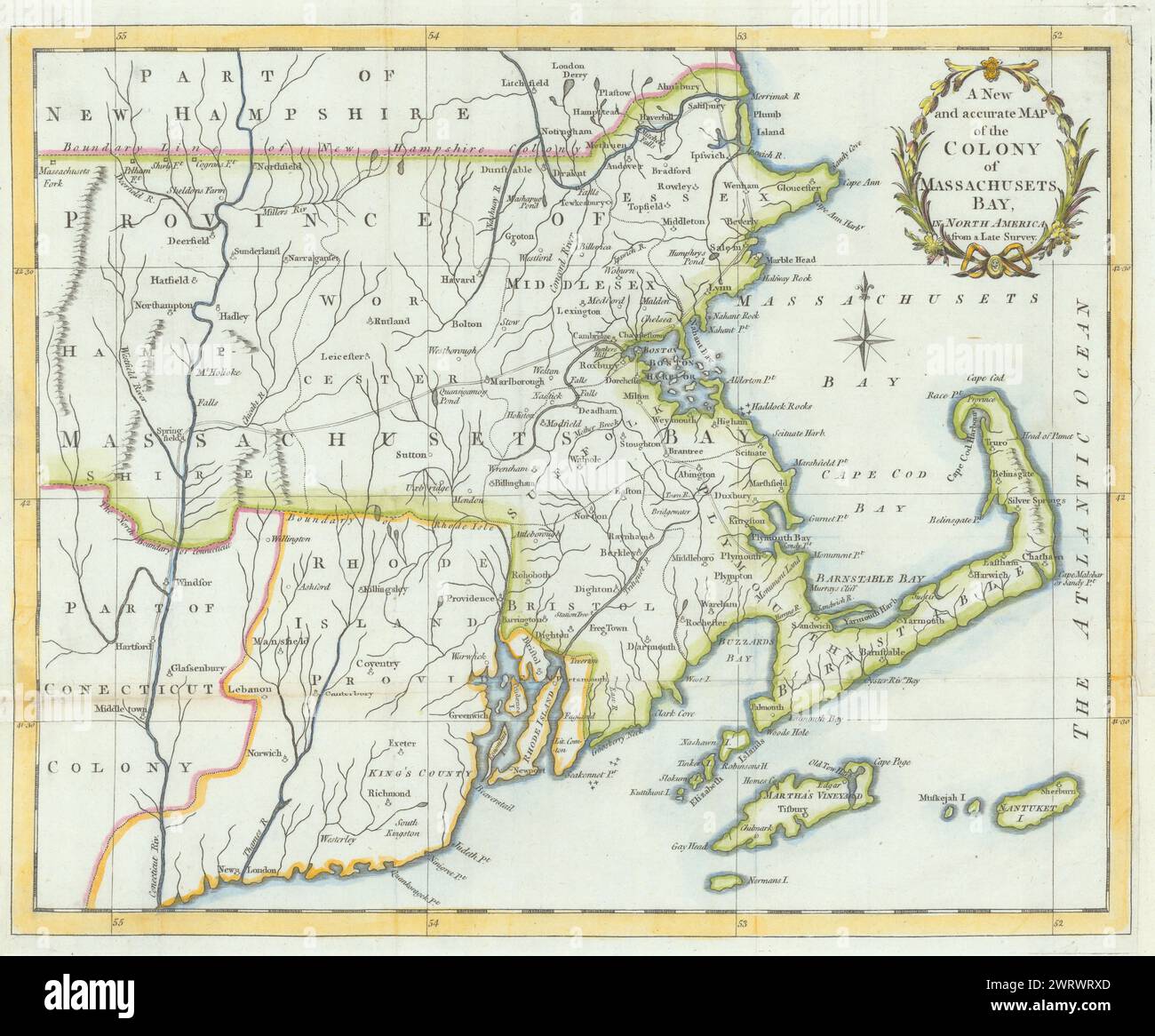
A New & accurate Map of the Colony of Massachusets Bay… Universal Magazine 1780
RFID:Image ID:2WRWRXD
Image details
Contributor:
Antiqua Print Gallery / Alamy Stock PhotoImage ID:
2WRWRXDFile size:
145.1 MB (8.2 MB Compressed download)Releases:
Model - no | Property - noDo I need a release?Dimensions:
7827 x 6481 px | 66.3 x 54.9 cm | 26.1 x 21.6 inches | 300dpiDate taken:
1780Location:
MassachusettsMore information:
This image could have imperfections as it’s either historical or reportage.
A New and accurate Map of the Colony of Massachusets Bay in North America, from a late Survey. Artist/engraver/cartographer: Universal Magazine. Provenance: "The Universal Magazine of knowledge and pleasure", London. Type: Antique hand coloured copperplate map.