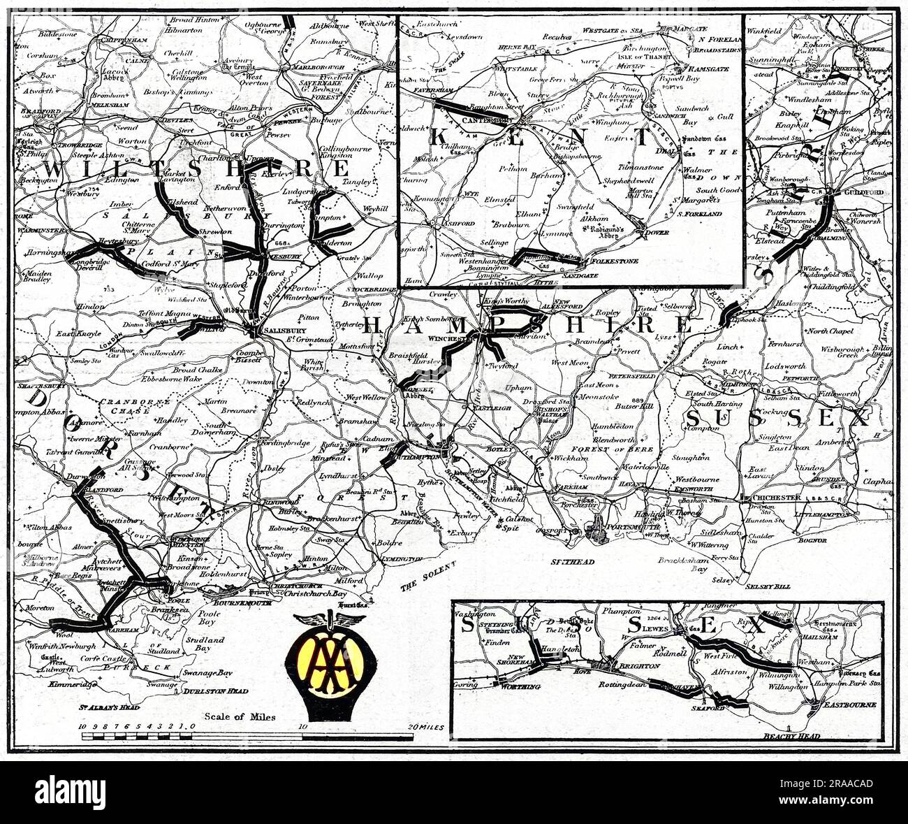
A map of the Southern counties of Britain prepared by the Automobile Association and the Motor Union to indicate the stretches of road extensively damaged by the passage of military traffic and which civilian motorists were advised to avoid. Roads in Wiltshire, Dorset, Hampshire, Sussex and Kent are all shown. Date: 1915
RMID:Image ID:2RAACAD
Image details
Contributor:
Chroma Collection / Alamy Stock PhotoImage ID:
2RAACADFile size:
55.2 MB (3.6 MB Compressed download)Releases:
Model - no | Property - noDo I need a release?Dimensions:
4800 x 4022 px | 40.6 x 34.1 cm | 16 x 13.4 inches | 300dpiMore information:
This image could have imperfections as it’s either historical or reportage.