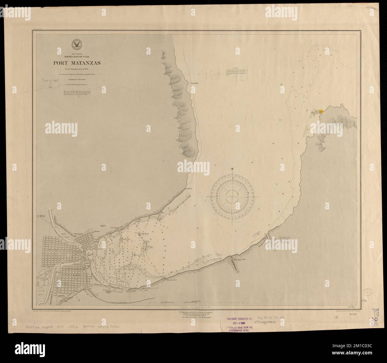
West Indies, north coast of Cuba, Port Matanzas : from a Spanish survey in 1892 , Nautical charts, Cuba, Matanzas Bay, Matanzas Bay Cuba, Maps, Matanzas Cuba, Maps Norman B. Leventhal Map Center Collection
RMID:Image ID:2M1C03C
Image details
Contributor:
piemags/DCM / Alamy Stock PhotoImage ID:
2M1C03CFile size:
95 MB (3 MB Compressed download)Releases:
Model - no | Property - noDo I need a release?Dimensions:
6186 x 5368 px | 52.4 x 45.4 cm | 20.6 x 17.9 inches | 300dpiMore information:
This image is a public domain image, which means either that copyright has expired in the image or the copyright holder has waived their copyright. Alamy charges you a fee for access to the high resolution copy of the image.
This image could have imperfections as it’s either historical or reportage.