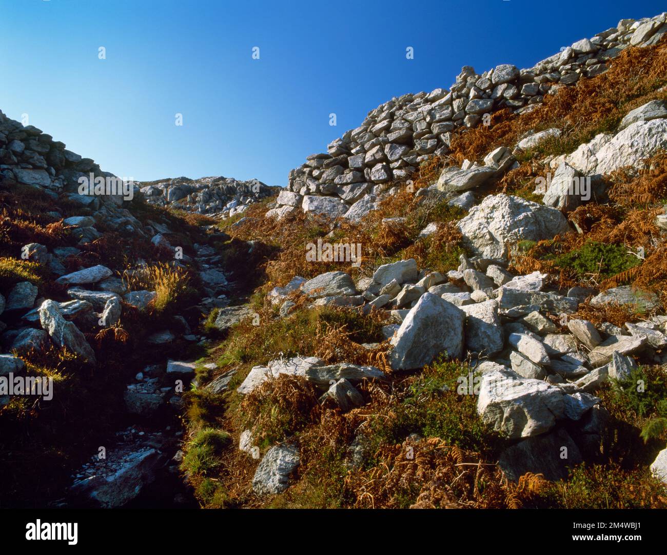
View WSW up through the NE entrance into Caer y Twr Iron Age hillfort, Holyhead Mountain, Isle of Anglesey, Wales, UK, flanked by drystone ramparts.
Image details
Contributor:
Mick Sharp / Alamy Stock PhotoImage ID:
2M4WBJ1File size:
53.8 MB (2.8 MB Compressed download)Releases:
Model - no | Property - noDo I need a release?Dimensions:
4961 x 3791 px | 42 x 32.1 cm | 16.5 x 12.6 inches | 300dpiDate taken:
20 October 2007Location:
Caer y Twr Hillfort, Holyhead Mountain, Holyhead, Isle of Anglesey, Wales, UKMore information:
View WSW up through the entrance into Caer y Twr Iron Age hillfort, Holyhead Mountain, Isle of Anglesey, Wales, UK. Drystone walls on the N & E sides of a rocky summit defend an area of some 7 hectares (17.3 acres) with an entrance at the NE corner through a natural gulley flanked by the incurving ends of the ramparts. The single drystone rampart survives to a height of 3m in places with an outer & inner face of massive masonry revetting a rubble core. Where best preserved the wall is 4m wide & topped by a parapet walk. The rocky summit is marked by an Ordnance Survey trigulation point & the foundations of a Roman signal tower used in conjunction with their naval base at Caer Gybi, Holyhead. A short stretch of the hillfort's N wall has been deliberately thrown down, perhaps as a Roman military exercise.