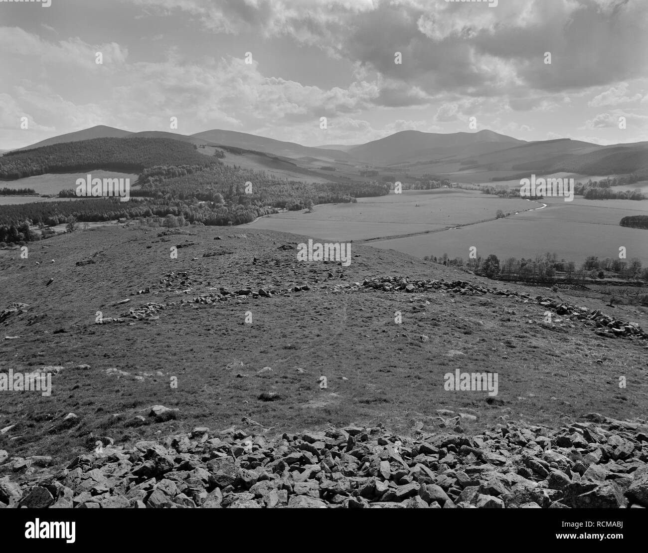
View SW over two stone ramparts & external chevaux-de-frise (defensive setting of upright stones) of Dreva Craig Iron Age hillfort, Scottish Borders.
RMID:Image ID:RCMABJ
Image details
Contributor:
Mick Sharp / Alamy Stock PhotoImage ID:
RCMABJFile size:
55.2 MB (2.5 MB Compressed download)Releases:
Model - no | Property - noDo I need a release?Dimensions:
4961 x 3890 px | 42 x 32.9 cm | 16.5 x 13 inches | 300dpiDate taken:
25 May 1988Location:
Dreva Craig, Broughton, Tweeddale, Scottish Borders, Scotland, UKMore information:
View SW over the two stone ramparts & external chevaux-de-frise (a defensive setting of upright stones) of Dreva Craig Iron Age hillfort, Scottish Borders, UK. Over 100 of the stones, designed to prevent the use of chariots, or break up an infantry or cavalry charge, remain in position over an area of 650sq.m. In use during the 1st centuries BC & AD, the fort was "stratigically positioned to command the eastern end of the Biggar Gap, the valley which allows access between the upper stretches of the Rivers Tweed and Clyde." To the rear are the distinctive cone of Worm Hill (L) & the river Holms Water running through farmland centre R.