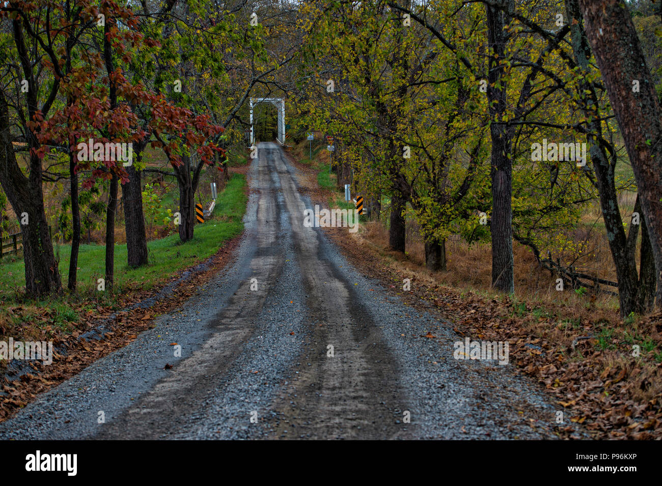
UNITED STATES - 10-23-2017: Catoctin Creek Bridge was originally located at a crossing of nearby Goose Creek, carrying the Leesburg Turnpike, later Vi
Image details
Contributor:
William Graham / Alamy Stock PhotoImage ID:
P96KXPFile size:
68.8 MB (6.2 MB Compressed download)Releases:
Model - no | Property - noDo I need a release?Dimensions:
6010 x 4000 px | 50.9 x 33.9 cm | 20 x 13.3 inches | 300dpiDate taken:
23 October 2017More information:
UNITED STATES - 10-23-2017: Catoctin Creek Bridge was originally located at a crossing of nearby Goose Creek, carrying the Leesburg Turnpike, later Virginia State Route 7, but was relocated in 1932 to its present location at Catoctin Creek. The Catoctin Creek Bridge was placed on the National Register of Historic Places on June 24, 1974. Western Loudoun's historic dirt road known as Featherbed Lane outside of the Village of Waterford. Many of the dirt roads in Loudoun are important heritage resources that represent the migration, settlement and travel patterns of the County's early populations. Historic travel routes are also essential components of the County's historic landscape as it associates with standing structures, linking early settlements. (Photo by Douglas Graham/Loudoun Now)