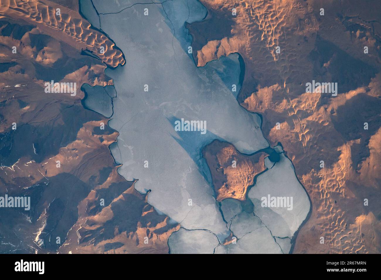
Ulaagchinii Khar Nuur, Ulaagchinii Khar Nuur National Park, Mongolia.
Image details
Contributor:
NASA Archive / Alamy Stock PhotoImage ID:
2R67MRNFile size:
59.1 MB (3.9 MB Compressed download)Releases:
Model - no | Property - noDo I need a release?Dimensions:
5568 x 3712 px | 47.1 x 31.4 cm | 18.6 x 12.4 inches | 300dpiDate taken:
6 May 2021More information:
This image could have imperfections as it’s either historical or reportage.
Ulaagchinii Khar Nuur The shadows accentuate the topography in and around the lake, including the Big and Small Avgash Islands. Cracks permeate the ice-covered surface of the lake, and dunes skirt the shore. The cold, flat ice surface contrasts with the distinctive, rolling waves of sand dunes. While typically associated with hot climates, dunes can form in all deserts, including the cold steppe of western Mongolia. Though located in Mongolia’s Great Lakes Depression, the water surface of Khar Nuur Lake is still more than 1900 meters (6, 400 feet) above sea level. Due to the high altitude and location, temperatures in the freshwater lake (//mongolija.upese.lt/index.php/en/lakes) dip below freezing for most of the winter months. Situated in central Asia between China and Russia, Mongolia sits in the subarctic zone where cold air from Siberia extends winter climate patterns well into April.