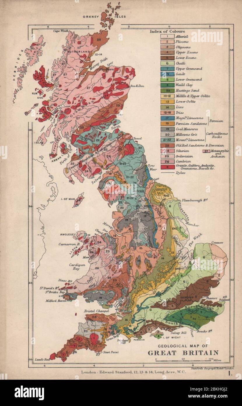
UK Geological map of Great Britain 1907 old antique vintage plan chart
RFID:Image ID:2BKHGJ2
Image details
Contributor:
Antiqua Print Gallery / Alamy Stock PhotoImage ID:
2BKHGJ2File size:
8.6 MB (511.2 KB Compressed download)Releases:
Model - no | Property - noDo I need a release?Dimensions:
1389 x 2173 px | 23.5 x 36.8 cm | 9.3 x 14.5 inches | 150dpiDate taken:
1907Location:
UKMore information:
This image could have imperfections as it’s either historical or reportage.
Great Britain. Artist/engraver/cartographer: Edward Stanford Ltd. Provenance: "Stanford Geological Atlas of Great Britain and Ireland"; by Horace B. Woodward, Second edition. Published by Edward Stanford, Ltd., London [Stanford Geological atlas - British Isles]. Type: Antique colour map.