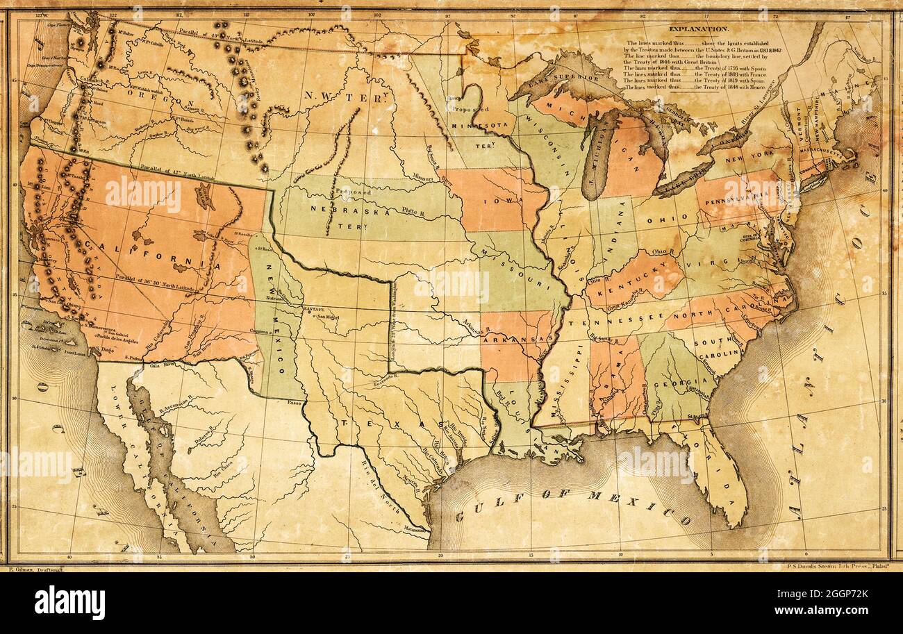
This map was presented during US President James K. Polk's annual message to Congress in December 1848. It shows Polk's vision of how to divide up the new territory acquired through the Treaty of Guadalupe-Hidalgo, at the end of the Mexican-American War. Mexico ceded 55 percent of its territory, including parts of present-day Arizona, California, New Mexico, Texas, Colorado, Nevada, and Utah, to the United States.
RMID:Image ID:2GGP72K
Image details
Contributor:
Science History Images / Alamy Stock PhotoImage ID:
2GGP72KFile size:
26.7 MB (1.7 MB Compressed download)Releases:
Model - no | Property - noDo I need a release?Dimensions:
3840 x 2433 px | 32.5 x 20.6 cm | 12.8 x 8.1 inches | 300dpiDate taken:
10 April 2008Photographer:
Science History ImagesMore information:
This image could have imperfections as it’s either historical or reportage.