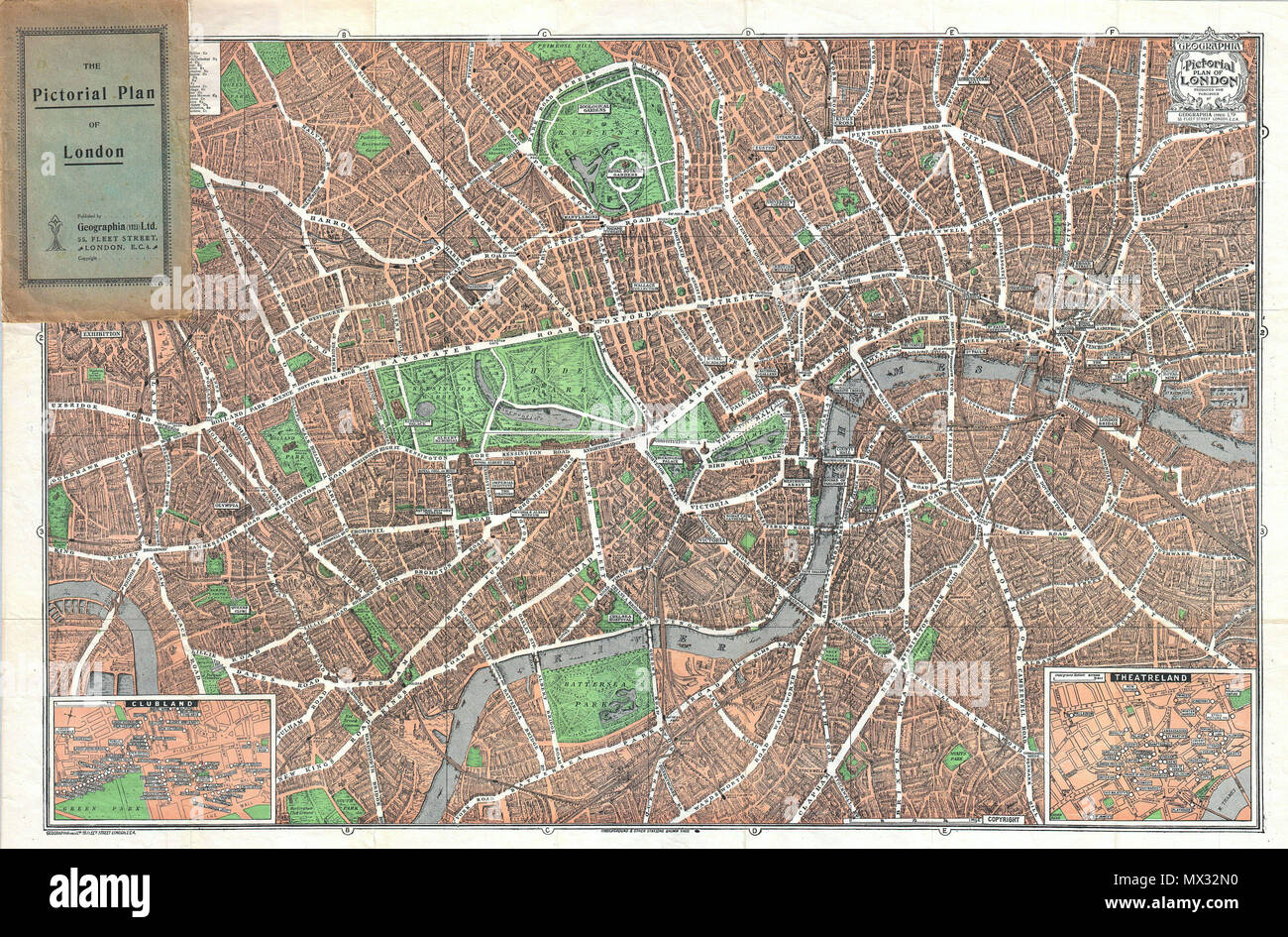
. The Pictorial Plan of London. English: This is a wonderful map of pocket map of London and published in 1923 by Geographia Ltd. Cover downtown London from the Hammersmith Bridge and Wormwood scrubs eastward past Hyde Park and Buckingham Place to Whitechapel Road and the London Docks. Features many of the buildings of London drawn in three dimensions. Insets in the lower right and lower left depict Theater land and Clubland, respectively. Both insets detail individual establishments as they existed at the time including the Ladies Automobile Club, the Athenaeum, the Palace Theater, the Hippo
Image details
Contributor:
The Picture Art Collection / Alamy Stock PhotoImage ID:
MX32N0File size:
14.3 MB (2.3 MB Compressed download)Releases:
Model - no | Property - noDo I need a release?Dimensions:
2755 x 1814 px | 23.3 x 15.4 cm | 9.2 x 6 inches | 300dpiMore information:
This image is a public domain image, which means either that copyright has expired in the image or the copyright holder has waived their copyright. Alamy charges you a fee for access to the high resolution copy of the image.
This image could have imperfections as it’s either historical or reportage.
. The Pictorial Plan of London. English: This is a wonderful map of pocket map of London and published in 1923 by Geographia Ltd. Cover downtown London from the Hammersmith Bridge and Wormwood scrubs eastward past Hyde Park and Buckingham Place to Whitechapel Road and the London Docks. Features many of the buildings of London drawn in three dimensions. Insets in the lower right and lower left depict Theater land and Clubland, respectively. Both insets detail individual establishments as they existed at the time including the Ladies Automobile Club, the Athenaeum, the Palace Theater, the Hippodrome Theater and the Coliseum Theater, among many others. Notes stations on the London Underground. . 1923 (dated) 12 1923 Geographica Pocket Map of London, England - Geographicus - London-geographica-1923