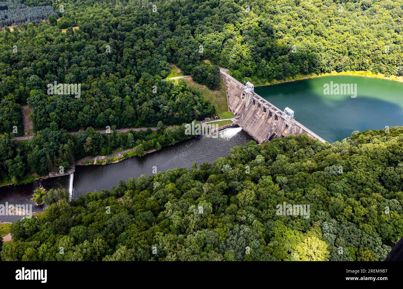
The photo above is an aerial view of Mahoning Creek Lake dam in Dayton, Pennsylvania, July 21, 2023. Mahoning Creek Lake is one of 16 flood risk reduction projects in the Pittsburgh District. Mahoning provides flood protection for the lower Allegheny and upper Ohio rivers. The U.S. Army Corps of Engineers started constructing Mahoning in 1939 and completed in June 1941, becoming fully operational the same month. Pittsburgh District’s 26,000 square miles include portions of western Pennsylvania, northern West Virginia, eastern Ohio, western Maryland, and southwestern New York. It has more than
Image details
Contributor:
APFootage / Alamy Stock PhotoImage ID:
2REM9B7File size:
68.7 MB (5 MB Compressed download)Releases:
Model - no | Property - noDo I need a release?Dimensions:
6083 x 3945 px | 51.5 x 33.4 cm | 20.3 x 13.2 inches | 300dpiDate taken:
21 July 2023More information:
This image could have imperfections as it’s either historical or reportage.
The photo above is an aerial view of Mahoning Creek Lake dam in Dayton, Pennsylvania, July 21, 2023. Mahoning Creek Lake is one of 16 flood risk reduction projects in the Pittsburgh District. Mahoning provides flood protection for the lower Allegheny and upper Ohio rivers. The U.S. Army Corps of Engineers started constructing Mahoning in 1939 and completed in June 1941, becoming fully operational the same month. Pittsburgh District’s 26, 000 square miles include portions of western Pennsylvania, northern West Virginia, eastern Ohio, western Maryland, and southwestern New York. It has more than 328 miles of navigable waterways, 23 navigation locks and dams, 16 multi-purpose flood-control reservoirs, 42 local flood-protection projects, and other projects to protect and enhance the nation’s water resources infrastructure and environment. (U.S. Army Corps of Engineers Pittsburgh District photo by Michel Sauret)