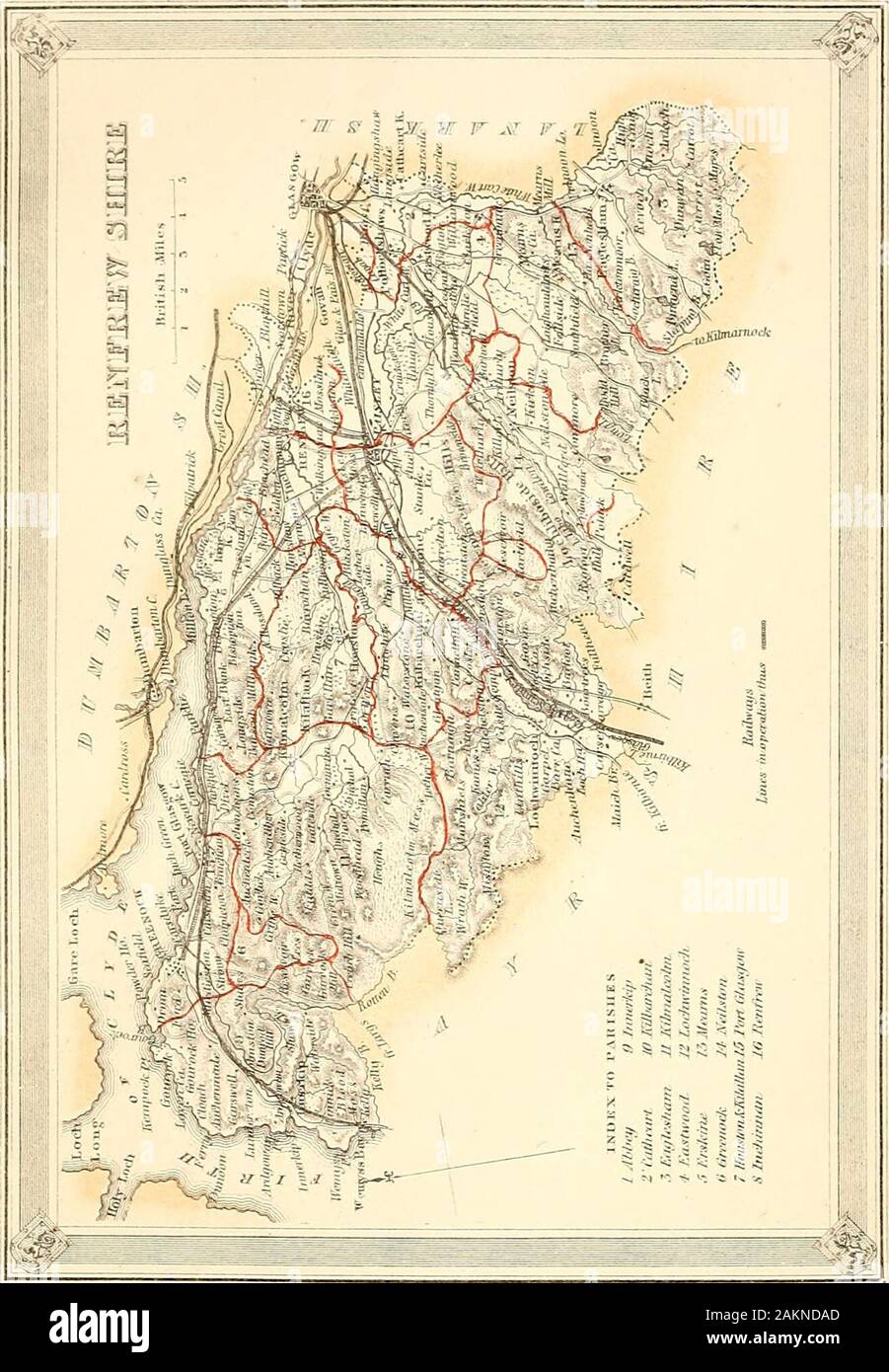
The imperial gazetteer of Scotland; or, Dictionary of Scottish topography, compiled from the most recent authorities, and forming a complete body of Scottish geography, physical, statistical, and historical . hbourhood, butof a great gorgeous panorama away to the Gram-pians and the Lowthers. The flat division of thecounty comprehends the greater part of the parishof Renfrew, and parts of the parishes of Paisley,Kilbarchan, Inchinnan, Houston, and Erskine. itconsists chiefly of a level tract, extending north andnorth-west of the town of Paisley to the Clyde andto the Erskine hills, and called b
Image details
Contributor:
The Reading Room / Alamy Stock PhotoImage ID:
2AKNDADFile size:
7.1 MB (475.3 KB Compressed download)Releases:
Model - no | Property - noDo I need a release?Dimensions:
1316 x 1898 px | 22.3 x 32.1 cm | 8.8 x 12.7 inches | 150dpiMore information:
This image is a public domain image, which means either that copyright has expired in the image or the copyright holder has waived their copyright. Alamy charges you a fee for access to the high resolution copy of the image.
This image could have imperfections as it’s either historical or reportage.
The imperial gazetteer of Scotland; or, Dictionary of Scottish topography, compiled from the most recent authorities, and forming a complete body of Scottish geography, physical, statistical, and historical . hbourhood, butof a great gorgeous panorama away to the Gram-pians and the Lowthers. The flat division of thecounty comprehends the greater part of the parishof Renfrew, and parts of the parishes of Paisley, Kilbarchan, Inchinnan, Houston, and Erskine. itconsists chiefly of a level tract, extending north andnorth-west of the town of Paisley to the Clyde andto the Erskine hills, and called by the inhabitants the laigh-lands. Put a belt of low-land, of thecharacter of a valley, strikes off from this in thevicinity of Paisley, extends south-westward throughthe parishes of Kilbarchan and Lochwinnoch to thehead of Kilbirnie loch, on the boundary with Ayr-shire, and bears every mark of having, at a veryrecent geological period, been occupied by water. The streams of Renfrewshire are remarkable fortheir extensive subordination to trade and industry.The Clyde, throughout all its connexion with thecounty, is laden with commerce. The Cart, flowinginto the Clyde between the parishes of Renfrew and. RENFREWSHIRE. 651 RENFREWSHIRE. Inchinnan, is the discmboguement of the watersfrom at least five-sixths of all the interior of thecounty; and it brings down the washings of bleaeh-fiekls, dye-works, cotton-factories, and other hivesof industry, more perhaps than any other equalvolume of water in Scotland. Its principal head-streams are the Gryfe, the Black Cart, and theWhite Cart; and the most noticeable feeders ofthese are the Locher, the Calder, and the Levern.The largest of the streams not belonging to thebasin of the Cart, is the Kip, which runs westwardto the frith of Clyde in the parish of Innerkip. Anumber of the brooks among the hills, particularlyto the south of Greenock, and in the parishes ofPaisley, Neilston, and Eaglesham, are dammed upto form reservoirs, which aggre