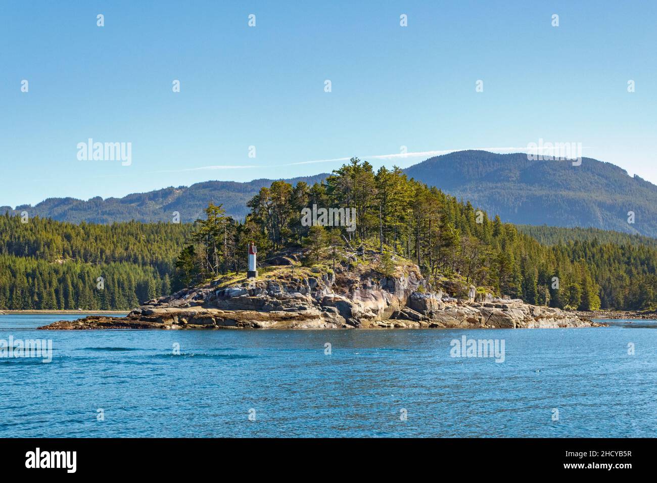
Summer sea level view of an islet with a navigation marker (at Greene Point Rapids in Cordero Channel on British Columbia's Inside Passage).
RFID:Image ID:2HCYB5R
Image details
Contributor:
Laurie MacBride / Alamy Stock PhotoImage ID:
2HCYB5RFile size:
58.1 MB (3.2 MB Compressed download)Releases:
Model - no | Property - noDo I need a release?Dimensions:
5518 x 3679 px | 46.7 x 31.1 cm | 18.4 x 12.3 inches | 300dpiDate taken:
25 June 2021Location:
Griffiths Islet in Cordero Channel, British Columbia, CanadaMore information:
The islet in the photo is Griffiths Islet, adjacent to Greene Point Rapids, shown here near the time of slack current. On spring tides the current at Greene Point Rapids can run up to 7 knots, creating considerable turbulence. The lighted beacon on Griffiths Islet is maintained by the Canadian Coast Guard.