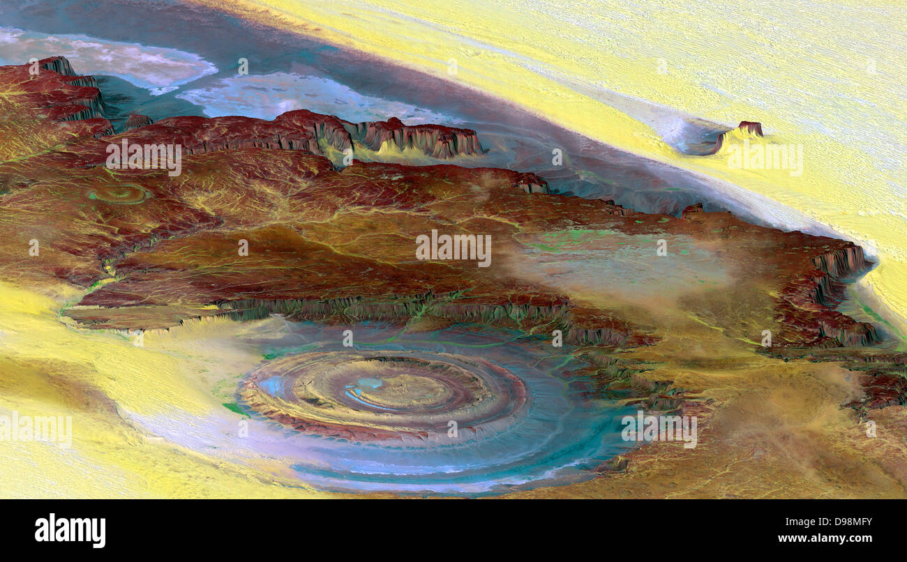
This prominent circular feature, known as the Richat Structure, in the Sahara desert of Mauritania is often noted by astronauts because it forms a conspicuous 50-kilometer-wide (30-mile-wide) bull's-eye on the otherwise rather featureless expanse of the desert. Initially mistaken for a possible impact crater, it is now known to be an eroded circular anticline (structural dome) of layered sedimentary rocks. This view was generated from a Landsat satellite image draped over an elevation model produced by the Shuttle Radar Topography Mission (SRTM). taken in 2000.
RMID:Image ID:D98MFY
Image details
Contributor:
World History Archive / Alamy Stock PhotoImage ID:
D98MFYFile size:
54.9 MB (3.2 MB Compressed download)Releases:
Model - no | Property - noDo I need a release?Dimensions:
5900 x 3250 px | 50 x 27.5 cm | 19.7 x 10.8 inches | 300dpiPhotographer:
World History ArchiveMore information:
This image could have imperfections as it’s either historical or reportage.
This prominent circular feature, known as the Richat Structure, in the Sahara desert of Mauritania is often noted by astronauts because it forms a conspicuous 50-kilometer-wide (30-mile-wide) bull's-eye on the otherwise rather featureless expanse of the desert. Initially mistaken for a possible impact crater, it is now known to be an eroded circular anticline (structural dome) of layered sedimentary rocks. This view was generated from a Landsat satellite image draped over an elevation model produced by the Shuttle Radar Topography Mission (SRTM). taken in 2000.