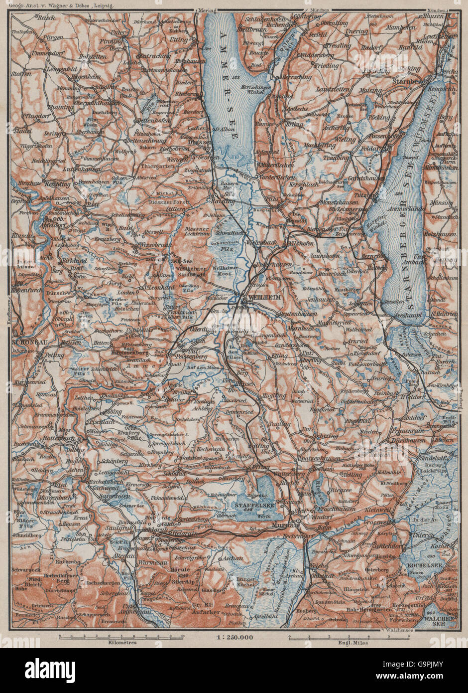
STARNBERGERSEE & AMMERSEE. Weilheim Schongau Murnau Starnberg karte, 1902 map
RFID:Image ID:G9PJMY
Image details
Contributor:
Antiqua Print Gallery / Alamy Stock PhotoImage ID:
G9PJMYFile size:
12.6 MB (1.5 MB Compressed download)Releases:
Model - no | Property - noDo I need a release?Dimensions:
1787 x 2471 px | 30.3 x 41.8 cm | 11.9 x 16.5 inches | 150dpiDate taken:
1902Location:
GermanyMore information:
This image could have imperfections as it’s either historical or reportage.
Artist/engraver/cartographer: Wagner & Debes. Provenance: "Southern Germany"; by Karl Baedeker, Published by Karl Baedeker, London: 9th Edition. Type: Antique colour map; Scale 1:250.000.